Where to ride in Asotin County
No single Asotin County corridor covers the county. The routes below mix published lengths from each trail's own manager listing with honest access records where no named measured route was located. Surfaces range from asphalt city paths to crushed-stone and ballast rail beds. Willamette Valley paths face wind and rain, the Columbia Gorge and high desert face hard afternoon wind and summer heat, and the coast runs cool and damp even in July.
Compare the five route options
No single route fits every rider or every electric bicycle. Compare distance, starting point, surface, and managing authority before choosing.
Palouse To Cascades State Park Trail (nearby, Whitman County)
Start from Rattlesnake Lake Recreation Area (North Bend) to 4962 Lower Crab Creek Rd SW (Royal City) and E 1st St. (Warden) to Washington/Idaho Border. The documented distance is 245.6 miles published length. Expect Ballast, Crushed Stone, Dirt, Gravel. Confirm the access note before choosing this over another Asotin County option.
Spokane River Centennial Trail (regional day trip, Spokane County)
Start from WA-ID State Line and Riverside State Park (Nine Mile Falls). The documented distance is 40 miles published length. Expect Asphalt. Confirm the access note before choosing this over another Asotin County option.
Appleway Trail (regional day trip, Spokane County)
Start from S. Farr Road and E. Appleway Blvd. (Spokane Valley) and E. Appleway Drive and E. Broadway Ave. (Liberty Lake). The documented distance is 5.8 miles published length. Expect Asphalt. Confirm the access note before choosing this over another Asotin County option.
Columbia Plateau Trail State Park (regional day trip, Adams County)
Start from Fish Lake Regional Park, 14314 S Myers Park Rd. (Cheney) and Martindale Rd. (Pasco). The documented distance is 126 miles published length. Expect Asphalt, Ballast, Crushed Stone, Dirt, Grass, Gravel. Confirm the access note before choosing this over another Asotin County option.
Ferry County Rail Trail (regional day trip, Ferry County)
Start from USA/Canada Border (Danville) and Golden Tiger Pathway (Republic). The documented distance is 25 miles published length. Expect Ballast, Crushed Stone. Confirm the access note before choosing this over another Asotin County option.
eBike shop hubs
Use these city directories for addresses, phone numbers, detail pages, and claim links. A city page is a contact index, not proof of current rental stock or route access.
These cards are preserved for repair, sales, or general service enquiries. They are not presented as rental operators.
Motorsports store · Clarkston, WA
★★★★½4.7(315 reviews)
📍 700 Bridge St Clarkston, WA 99403
📞 (509) 758-5343
Named eBike routes and access checks
1. Palouse To Cascades State Park Trail (nearby, Whitman County)
Distance: 245.6 miles published length
Start: Rattlesnake Lake Recreation Area (North Bend) to 4962 Lower Crab Creek Rd SW (Royal City) and E 1st St. (Warden) to Washington/Idaho Border
Surface and rider fit: Ballast, Crushed Stone, Dirt, Gravel
eBike access: eBike access: Palouse To Cascades State Park Trail is a manager-listed bicycling route over ballast, crushed stone, dirt, gravel. Washington treats a Class 1, 2 or 3 electric-assisted bicycle as a bicycle, but the managing authority can be narrower, so confirm the current notice for this segment before riding it from Asotin County.
Etiquette and planning: Documented corridor serving Adams, Grant, King, Kittitas, Spokane, Whitman counties. Treat the published length as the whole corridor, not a county-exclusive loop, and plan the turnaround by time and battery. From Asotin County, treat this as a drive-in option rather than a local loop.
Palouse To Cascades State Park Trail (nearby, Whitman County) official or managing-source information
2. Spokane River Centennial Trail (regional day trip, Spokane County)
Distance: 40 miles published length
Start: WA-ID State Line and Riverside State Park (Nine Mile Falls)
Surface and rider fit: Asphalt
eBike access: eBike access: Spokane River Centennial Trail is a manager-listed bicycling route over asphalt. Washington treats a Class 1, 2 or 3 electric-assisted bicycle as a bicycle, but the managing authority can be narrower, so confirm the current notice for this segment before riding it from Asotin County.
Etiquette and planning: Documented corridor in Spokane counties. Treat the published length as the whole corridor, plan the turnaround by time and battery, and allow travel time to the trailhead. From Asotin County, treat this as a drive-in option rather than a local loop.
Spokane River Centennial Trail (regional day trip, Spokane County) official or managing-source information
3. Appleway Trail (regional day trip, Spokane County)
Distance: 5.8 miles published length
Start: S. Farr Road and E. Appleway Blvd. (Spokane Valley) and E. Appleway Drive and E. Broadway Ave. (Liberty Lake)
Surface and rider fit: Asphalt
eBike access: eBike access: Appleway Trail is a manager-listed bicycling route over asphalt. Washington treats a Class 1, 2 or 3 electric-assisted bicycle as a bicycle, but the managing authority can be narrower, so confirm the current notice for this segment before riding it from Asotin County.
Etiquette and planning: Documented corridor in Spokane counties. Treat the published length as the whole corridor, plan the turnaround by time and battery, and allow travel time to the trailhead. From Asotin County, treat this as a drive-in option rather than a local loop.
Appleway Trail (regional day trip, Spokane County) official or managing-source information
4. Columbia Plateau Trail State Park (regional day trip, Adams County)
Distance: 126 miles published length
Start: Fish Lake Regional Park, 14314 S Myers Park Rd. (Cheney) and Martindale Rd. (Pasco)
Surface and rider fit: Asphalt, Ballast, Crushed Stone, Dirt, Grass, Gravel
eBike access: eBike access: Columbia Plateau Trail State Park is a manager-listed bicycling route over asphalt, ballast, crushed stone, dirt, grass, gravel. Washington treats a Class 1, 2 or 3 electric-assisted bicycle as a bicycle, but the managing authority can be narrower, so confirm the current notice for this segment before riding it from Asotin County.
Etiquette and planning: Documented corridor in Adams, Franklin, Lincoln, Spokane, Whitman counties. Treat the published length as the whole corridor, plan the turnaround by time and battery, and allow travel time to the trailhead. From Asotin County, treat this as a drive-in option rather than a local loop.
Columbia Plateau Trail State Park (regional day trip, Adams County) official or managing-source information
5. Ferry County Rail Trail (regional day trip, Ferry County)
Distance: 25 miles published length
Start: USA/Canada Border (Danville) and Golden Tiger Pathway (Republic)
Surface and rider fit: Ballast, Crushed Stone
eBike access: eBike access: Ferry County Rail Trail is a manager-listed bicycling route over ballast, crushed stone. Washington treats a Class 1, 2 or 3 electric-assisted bicycle as a bicycle, but the managing authority can be narrower, so confirm the current notice for this segment before riding it from Asotin County.
Etiquette and planning: Documented corridor in Ferry counties. Treat the published length as the whole corridor, plan the turnaround by time and battery, and allow travel time to the trailhead. From Asotin County, treat this as a drive-in option rather than a local loop.
Ferry County Rail Trail (regional day trip, Ferry County) official or managing-source information
Half-day and full-day eBike plans
Half day: start with Palouse To Cascades State Park Trail (nearby, Whitman County) from Rattlesnake Lake Recreation Area (North Bend) and turn around at half your comfortable range.
Full day: combine Spokane River Centennial Trail (regional day trip, Spokane County) with Appleway Trail (regional day trip, Spokane County) only if the weather, surface and battery reserve support both, and keep the third as a fallback.
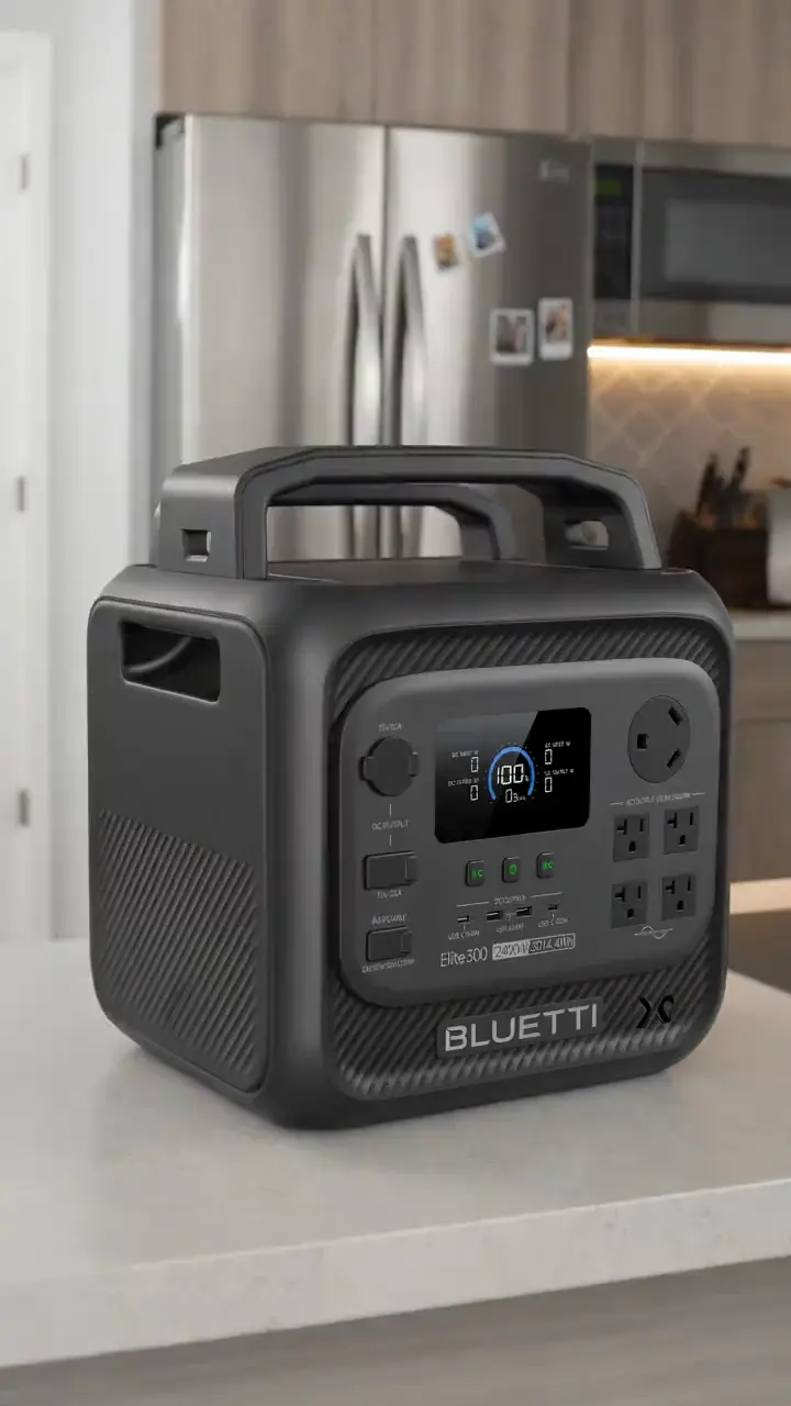
For a route day in Asotin County, carry water, a charged phone, the managing source, and only the tools you know how to use. A portable power station for a Asotin County trailhead base is an optional charging accessory, not permission to plug in or a substitute for conservative range planning. Build the Asotin County return around the battery already on the bike; never assume a public trailhead outlet is available.
Plan the route, service stop, and return together
A useful Asotin County plan starts with one documented route, not a list of pins. Compare Palouse To Cascades State Park Trail (nearby, Whitman County), Spokane River Centennial Trail (regional day trip, Spokane County), and Appleway Trail (regional day trip, Spokane County) by start point and surface. Put the longest or least certain option first only when weather, daylight, and battery reserve support it. Otherwise, choose the shorter confirmed outing and keep the second route as a true fallback.
Use Clarkston as the first service hub for Asotin County riders because it is represented by an existing directory card. Call about repairs or rentals before driving. A shop cannot override a park, trail authority, road closure, or private owner. Keep the manager’s source open on the same phone that holds the route and emergency contacts.
For each of the five Asotin County entries above, note whether the mileage is a loop, one way, or chosen by turnaround. Then budget the full return. Surface, elevation, temperature, wind, rider weight, assist level, and tire pressure all change consumption. Leave enough reserve to return without searching for an outlet. If the published information is incomplete, shorten this county ride rather than converting uncertainty into a precise claim.
What not to ride in Asotin County
Do not ride a Asotin County river path or rail corridor during flooding, and do not assume a converted rail bed is paved. Avoid exposed high-desert and Gorge corridors at midday in July and August, do not treat a nearby-county or regional route as a local loop, and do not ride a coastal path in a winter storm swell.
When to ride Asotin County
April through June and September through October are the best Asotin County months for a long ride. Summer riding works early or late, and winter city paths depend on whether the city has cleared snow and ice.
Washington eBike laws and route permission
RCW 46.04.169 defines an electric-assisted bicycle as a two- or three-wheeled bicycle with a saddle, working pedals and a motor of no more than 750 watts, and sorts it into three classes. Class 1 assists only while the rider pedals and stops assisting at 20 mph. Class 2 may be propelled by its motor and is not capable of assisting at 20 mph. Class 3 assists only while pedaling, stops assisting at 28 mph, and is equipped with a speedometer. That section also excludes a vehicle capable of exceeding 20 mph on its motor alone, and one intended to be easily reconfigured to fall outside the definition.
RCW 46.61.710 holds the access rules that decide a ride. The subsection barring mopeds from bicycle paths, trails and bikeways does not apply to electric-assisted bicycles, and electric-assisted bicycles may access highways and park like bicycles subject to RCW 46.61.160. Class 1 and Class 2 bicycles may be operated on a shared-use path or a highway section designated for bicycles, but a local jurisdiction or state agency may restrict that access and regulate the facilities, properties and rights-of-way it controls.
RCW 46.61.710(3) makes operating a Class 3 electric-assisted bicycle on a sidewalk unlawful unless there is no alternative as part of a bicycle or pedestrian path, or a local ordinance authorizes it under RCW 46.61.715. Washington sets no statewide all-ages bicycle helmet mandate in the sections reviewed, so helmet rules come from city and county ordinances; check the rule where you plan to ride. Read the Washington eBike laws guide, then check the current notice from the manager of the exact route.
Planning notes for Asotin County
Asotin County planning starts with the surface, not the shop list. 5 of the five routes below carry a published length taken from that trail's own manager listing, and the rest are labelled as regional day trips rather than local loops. Ride Palouse To Cascades State Park Trail (nearby, Whitman County) first from Rattlesnake Lake Recreation Area (North Bend) and treat its published length as the whole corridor, so pick a turnaround point that still leaves battery for the ride back. Asotin County surfaces run from asphalt city paths to crushed stone, ballast and cinder rail beds, and a wider tyre is worth more here than more motor. Check the managing agency notice for the exact segment on the morning you ride, because a closure, a resurfacing or a seasonal gate changes the plan more than any spec sheet does.
Frequently asked questions
Where should I start planning an eBike ride in Asotin County?
Start with Palouse To Cascades State Park Trail (nearby, Whitman County) for a Asotin County ride. Its documented start is Rattlesnake Lake Recreation Area (North Bend) to 4962 Lower Crab Creek Rd SW (Royal City) and E 1st St. (Warden) to Washington/Idaho Border. Check the linked manager information, current closures, and your bicycle class before travelling. Settle this before you ride a Asotin County route.
Does every bicycle route in Asotin County allow every eBike class?
No. Washington law distinguishes Class 1, Class 2, and Class 3 use, but a Asotin County route can still be narrower than state law: federal, state, municipal, and private managers apply route-specific rules, so a bicycle symbol on a sign is not universal electric-bicycle permission. Settle this before you ride a Asotin County route.
What helmet rule applies to electric bicycles in Washington?
RCW 46.61.710(3) makes it an offense for a rider or passenger under 16 to operate or ride a bicycle on a highway or on premises open to the public without approved protective headgear. Adults are not covered by that mandate, so helmet use for adults is safety guidance rather than a statewide requirement. Settle this before you ride a Asotin County route.
Do the Asotin County directory cards confirm rentals or battery repair?
No, and that applies to the Asotin County cards specifically. A directory card is a contact lead. Call with the date, rider height, bike brand, motor system, and intended route. Ask the business to confirm the exact rental, diagnostic, or repair service before travelling. Settle this before you ride a Asotin County route.
How should I estimate range for a Asotin County ride?
Use the full return distance for Palouse To Cascades State Park Trail (nearby, Whitman County) or the chosen alternative, not a best-case manufacturer range. Include elevation, surface, weather, detours, and the least confident rider in the plan. Settle this before you ride a Asotin County route.
What should I do when a Asotin County trailhead, bridge, or access road is closed?
On a Asotin County route, turn around and follow the manager’s closure notice. Do not bypass barriers or cross private property. Choose a separately confirmed route rather than inventing a connection on the ground. Settle this before you ride a Asotin County route.
All eBike shops in Asotin County
The complete local directory is the Asotin County eBike shops and repair contacts page. This guide owns route planning; the county hub owns the full shop list.