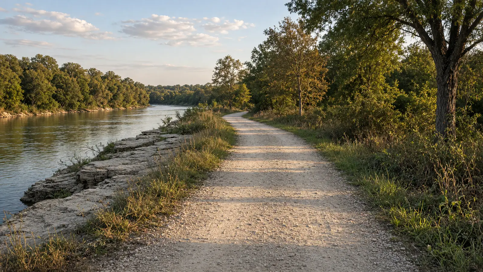
Things To Do on an eBike in Williamson County, TX
Three named trails make up a Williamson County eBike ride list: the Brushy Creek Regional Trail, the 183A Shared Use Path and Lake Creek Trail. The county manages Brushy Creek and Lake Creek. The Central Texas Regional Mobility Authority manages the 183A path. Who manages the trail decides which rules apply, so check the manager before you pick a route.
The county trails need the closest reading. Williamson County Parks rules, revised April 28, 2026, ban motorized bicycles, including electric ones, on trails not designated for them, and no Class 1, 2 or 3 list is published. The 183A path states no eBike rule, so Texas defaults apply there. On every route, the posted sign settles it.
Where to ride in Williamson County
Start at the Brushy Creek Trailhead if you want one stop that serves two routes. The Mobility Authority says parking is available there. The 183A path's southern end connects to the county's Brushy Creek Regional Trail by a pedestrian bridge. For the county trail alone, the newest phase begins just west of Chisholm Trail Road in Round Rock. Lake Creek Trail has its own trailhead with 20 parking spaces and benches.
Lake Creek Trail is shortest at about 1.5 miles, primarily concrete. The Brushy Creek Regional Trail is about 7.75 miles per Williamson County, mostly concrete, while TrailLink lists 10.9 miles with boardwalk, concrete and crushed stone. The 183A path is paved and 10 feet wide, with a published length of 7, 12 or almost 14 miles depending on the Mobility Authority page. The county parks motor vehicle rule covers the two county trails, and the 183A path publishes no eBike rule.
eBike shop hubs
Williamson County shops sit in six cities. Round Rock and Georgetown have four listings each, while Cedar Park, Taylor, Liberty Hill and Austin have fewer.
- eBike shops in Taylor
- eBike shops in Liberty Hill
- eBike shops in Round Rock
- eBike shops in Georgetown
- eBike shops in Cedar Park
- eBike shops in Austin
Other local service contacts
No rental listings show up for Williamson County right now, so these shops are the local contacts for service, parts and test rides. Call Taylor Bike Company or Freedom Bikes first to ask whether they work on your motor system and battery.

Named eBike routes and access checks
1. Brushy Creek Regional Trail, the county's main trail
Williamson County manages the Brushy Creek Regional Trail, and the county page lists approximately 7.75 miles, mostly concrete. The trail follows Brushy Creek between Round Rock and Cedar Park. Its newest phase is a 1 mile out and back just west of Chisholm Trail Road in Round Rock. From just west of Great Oaks Drive, the trail continues over 6 miles along Brushy Creek to Twin Lakes Park in Cedar Park. TrailLink lists 10.9 miles with boardwalk, concrete and crushed stone surfaces, so the county page and TrailLink disagree on length. The 183A path joins the trail by a pedestrian bridge at the path's southern end.
Distance: Approximately 7.75 miles, per the Williamson County trail page, while TrailLink lists 10.9 miles; start: Just west of Chisholm Trail Road in Round Rock, or just west of Great Oaks Drive for the longer stretch toward Twin Lakes Park in Cedar Park; surface: Mostly concrete per the county, with decomposed granite on the rest after planned drainage repairs, while TrailLink lists boardwalk, concrete and crushed stone.
eBike access: County Parks rule 1.18(A) bars motorized bicycles, including electric powered ones, on trails not designated for them. No Class 1, 2 or 3 list is published, so ride only where a sign or the county designates eBikes. Etiquette and planning: Keep your speed reasonable for trail conditions and under any posted limit, per county rule 1.18(B). Call out before passing walkers, and check the county page for repair work on drainage sections. Managing source: Williamson County, Brushy Creek Regional Trail.
2. Great Oaks Drive to Twin Lakes Park, the long stretch
This stretch is the longer part of the Brushy Creek Regional Trail. It starts just west of Great Oaks Drive and runs over 6 miles along Brushy Creek to Twin Lakes Park in Cedar Park, according to Williamson County. TrailLink lists end points at 1124 Forest Bluff Trl in Round Rock and 204 E Little Elm Trl in Cedar Park. A Cedar Park pedestrian bridge over Bell Avenue is in design to link Lakeline Park through Twin Lakes Park to the trail, about 1 mile, with no timeline. A 2 mile segment between Southwest Regional Park and the RR 1431 / Sam Bass Road intersection is in progress. Treat both as future additions.
Distance: Over 6 miles, per Williamson County; start: Just west of Great Oaks Drive along Brushy Creek, ending at Twin Lakes Park in Cedar Park; surface: Check the county page for current surface on this stretch, since the county describes the full trail as mostly concrete.
eBike access: County Parks rule 1.18(A) applies to this stretch. Electric bicycles count as motorized bicycles and are barred where the trail is not designated for them. Check the signs at Great Oaks Drive and Twin Lakes Park. Etiquette and planning: Plan for a longer one-way ride if you start at either end. Bring water and check the county page for repair work before you go. Managing source: Williamson County, Brushy Creek Regional Trail.
3. Brushy Creek Phase V, short out and back near Round Rock
The newest phase of the Brushy Creek Regional Trail is a 1 mile out and back just west of Chisholm Trail Road in Round Rock within Williamson County, and it suits a short test ride since you return the way you came. A 1.5 mile, 10-foot-wide segment between Faith Missionary Baptist Church and Sauls Ranch West is designed, with USACE permitting received in May 2026 and CAMPO grant funding. A Redbud Lane to Hutto connection of about 2.75 miles is exploratory, with no easements or land acquired, and both are future work. The Williamson County motorized bicycle rule applies to the open phase.
Distance: 1 mile out and back, per Williamson County; start: Just west of Chisholm Trail Road in Round Rock; surface: Check the manager page for current surface.
eBike access: County Parks rule 1.18(A) bars motorized bicycles, including electric powered ones, where the trail is not designated for them. No class list is published, so look for a posted designation before you ride. Etiquette and planning: Short out and back trails put riders and walkers head on. Keep right, ring a bell before passing, and keep your speed under any posted limit. Managing source: Williamson County, Brushy Creek Regional Trail.
4. 183A Shared Use Path, paved path beside the toll road
The Central Texas Regional Mobility Authority manages the 183A Shared Use Path, a paved 10-foot-wide path for bicycles and pedestrians that borders 183A Toll. Its southern end connects to Williamson County's Brushy Creek Regional Trail by a pedestrian bridge and includes a trailhead with exercise equipment. You do not have to take the toll road to reach it, and parking is available at the Brushy Creek Trailhead. The Mobility Authority publishes three lengths for the path. One page says 7 miles from south of Brushy Creek Road to Hero Way, another says almost 14 miles to Seward Junction Loop, and the 183A Toll page says 12 miles.
Distance: Mobility Authority pages give 7 miles to Hero Way, 12 miles to Seward Junction Loop, and almost 14 miles to Seward Junction Loop; start: Brushy Creek Trailhead, where the Mobility Authority says parking is available; surface: Paved and 10 feet wide, per the Mobility Authority.
eBike access: The Mobility Authority publishes no eBike rule, class limit or speed limit for the path, only that it is a dedicated bicycle and pedestrian path. Texas defaults apply, so check posted signs at the trailhead. Etiquette and planning: Expect walkers and bicycles on a 10-foot-wide path. Keep right, slow near the trailhead and the pedestrian bridge, and ride at a speed that suits the path width. Managing source: Central Texas Regional Mobility Authority, 183A Trail.
5. Lake Creek Trail, short concrete trail from Parmer Lane
Williamson County manages Lake Creek Trail, about 1.5 miles of primarily concrete along Lake Creek from Parmer Lane to Broadmeade Avenue. The county built it with a private developer and a pedestrian easement with Town and Country. The path passes through the Town and Country Optimist Fields, where Town and Country rules apply. Along the way it crosses one free-span pedestrian bridge and two low water crossings. The trailhead has 20 parking spaces and benches on 13 acres. The county page lists no trail-specific eBike rule beyond the county-wide motor vehicle prohibition, so the Parks rule on undesignated trails is the one to follow. Low water crossings can be wet after rain, so slow down.
Distance: About 1.5 miles, per Williamson County; start: The trailhead with 20 parking spaces and benches; the trail runs from Parmer Lane to Broadmeade Avenue; surface: Primarily concrete, with one free-span pedestrian bridge and two low water crossings.
eBike access: County Parks rule 1.18(A) bars motorized bicycles, including electric ones, on trails not designated for them. Town and Country rules apply through the Optimist Fields. Check signs at the trailhead before you ride. Etiquette and planning: Slow down through the Town and Country Optimist Fields and follow any rules posted there. Walk through the low water crossings if water is present. Managing source: Williamson County, Lake Creek Trail.
Planning a Williamson County ride
Charging is not published for any Williamson County trail, so charge at home before you ride. The 183A trailhead has parking and exercise equipment, and Lake Creek Trail has 20 parking spaces, but neither lists outlets. The Brushy Creek Regional Trail's long stretch past Great Oaks Drive covers over 6 miles one way, so plan your battery for the return.
Hours, fees and crowd levels are not published for these trails, so follow the posted signs at each trailhead and check the manager page the day you ride. The county planned to begin concrete repairs on erosion-prone drainage sections of the Brushy Creek Regional Trail in February 2026, so expect possible work zones. The Mobility Authority and the county each manage their own pages.
Half-day and full-day eBike plans
Half day: Park at the Brushy Creek Trailhead and ride the 183A Shared Use Path, a paved 10-foot-wide path. Check the sign before crossing the pedestrian bridge to the county's Brushy Creek Regional Trail, since county rules apply there. Lake Creek Trail, at about 1.5 miles, fits a shorter outing.
Full day: Spend the morning on the Brushy Creek Regional Trail from just west of Great Oaks Drive toward Twin Lakes Park in Cedar Park, over 6 miles one way, where signs designate eBikes. Eat in Cedar Park, then ride back. Finish on the 183A path if you still have battery.
Rainy-season backup: Choose the 183A Shared Use Path, since it is paved and 10 feet wide, over Lake Creek Trail, which has two low water crossings. Check the Mobility Authority page for conditions. The county says some Brushy Creek drainage sections are prone to erosion, so skip that trail after heavy rain.
What not to ride in Williamson County
County trails not designated for motorized bicycles: Any Williamson County trail not designated for motorized vehicles. Parks rule 1.18(A) makes it a violation to operate a motorized bicycle, including an electric powered one, there. No class list is published, so a Class 1 bike gets no exception. Park staff, public safety and emergency personnel are exempt.
Town and Country Optimist Fields: The Lake Creek Trail section through the Town and Country Optimist Fields is governed by Town and Country rules. Read posted signs before riding through. No trail-specific eBike rule is published beyond the county-wide motor vehicle prohibition, so ride only where designated.
Sidewalks: Texas law lets local authorities prohibit bicycles on sidewalks, and no Williamson County sidewalk eBike rule is published. Check city signs, and if you are unsure, use a designated path instead of the sidewalk.
Low water crossings after rain: Lake Creek Trail has two low water crossings, and the county says some Brushy Creek Regional Trail drainage sections are susceptible to erosion. Both are poor choices after heavy rain. Walk the crossings or wait for the water to drop.
When to ride Williamson County
Spring and fall are the comfortable seasons for most Central Texas riding, and summer afternoons run hot, so ride early or late. Trail hours and crowd levels are not published on the manager pages, so check them and the signs at the trailhead. Weekends are likely busier near trailheads with parking. After heavy rain, the low water crossings on Lake Creek Trail and the erosion-prone drainage sections on the Brushy Creek Regional Trail are the spots to avoid.
Texas eBike laws and route permission
Texas defines an eBike in Transportation Code 664.001. It must have fully operable pedals and a motor under 750 watts, with a top assisted speed of 28 mph or less. Class 1 is pedal-assist only and stops assisting at 20 mph. Class 2 can move the bike without pedaling, also up to 20 mph. Class 3 is pedal-assist that goes past 20 mph but stays under 28 mph. Section 541.201 says an eBike is not a motor vehicle, which is why car rules do not apply to it.
Under Transportation Code 551.106, TxDOT or a local authority may not ban eBikes on a highway used mainly by motor vehicles, or anywhere regular bicycles are allowed. The exception is a path closed to motor vehicles with a natural-surface tread, meaning cleared or graded native soil with no surfacing. Those managers may restrict eBikes there. Local authorities may also prohibit bicycles on sidewalks and set bicycle speed limits on paths. A Class 3 rider must be at least 15, though a passenger under 15 is allowed. The law has no age minimum for Class 1 or Class 2. Bills HB 4089 and SB 1865 in 2025 were left pending, so nothing changed.
Texas has no statewide helmet law for eBike riders. Local rules or a trail manager may still ask for one, and wearing one is smart on any eBike. Under Section 551.107, Subtitles A, B, and D of the Transportation Code do not apply, so there is no driver license, vehicle registration, or similar requirement for these bikes. The motor must stop assisting when you quit pedaling or squeeze the brakes. Check your county or city for local rules before you ride. For a fuller walkthrough, read our guide to Texas eBike laws.
Trail access in Texas depends on who manages the path. A city, county, or park manager can decide whether eBikes are allowed on a path closed to motor vehicles that has a natural-surface tread, which means cleared or graded native soil with no surfacing. Paved paths and any place regular bicycles may go are different, because the state bars local authorities from banning eBikes there. Before you head out, check the posted rules for the specific trail or park, since the dirt singletrack is where a ban is most likely.
Managers can also set bicycle speed limits on paths, so slow down where signs say so. Class matters too: Class 1 and Class 2 stop assisting at 20 mph, while Class 3 goes higher, and a Class 3 rider must be at least 15. The motor must cut out when you stop pedaling or brake. Ask the park office or check the trail website if the rules are unclear. This page does not list trail-specific limits, because those are set locally.
Williamson County Parks rules, revised April 28, 2026, define motor vehicles to include gasoline, diesel, electric, propane and battery powered vehicles. Sections 1.12 and 1.18 list a motorized bicycle, including electric powered, among them. Section 1.18(A) makes it a violation to operate one on a trail or path not designated for such vehicles, except for park staff, public safety and emergency personnel. No Class 1, 2 or 3 list is published. Read the Williamson County Parks Rules and Regulations.
Published figures disagree in two places. Williamson County lists the Brushy Creek Regional Trail at approximately 7.75 miles, while TrailLink lists 10.9 miles. The Mobility Authority gives the 183A path as 7 miles to Hero Way on its trail page, almost 14 miles on its project page and 12 miles on its 183A Toll page. Phase III is also described two ways. One page says it will extend north from Hero Way to Seward Junction Loop. The toll page says a 5-mile extension north of SH 29 opened in early 2025.
Several changes are pending as Williamson County planned to begin converting erosion-prone Brushy Creek drainage sections to concrete in February 2026. A 1.5 mile, 10-foot-wide segment between Faith Missionary Baptist Church and Sauls Ranch West received USACE permitting in May 2026 and CAMPO grant funding. A 2 mile segment between Southwest Regional Park and RR 1431 / Sam Bass Road is in progress. A Cedar Park bridge over Bell Avenue is in design with no timeline, and a Redbud Lane to Hutto link is exploratory. See the Brushy Creek project updates from Williamson County.
Frequently asked questions
Is the Brushy Creek Regional Trail being extended?
Yes, Williamson County lists a 2 mile segment between Southwest Regional Park and RR 1431 / Sam Bass Road as in progress, and a 1.5 mile, 10-foot-wide segment near Sauls Ranch West with USACE permitting in May 2026 and CAMPO grant funding. A Redbud Lane to Hutto link of about 2.75 miles is exploratory.
Where does the 183A Shared Use Path start?
Start at the Brushy Creek Trailhead, where parking is available. The path runs from south of Brushy Creek Road, and its southern end connects to the county's Brushy Creek Regional Trail by a pedestrian bridge. Its northern end is listed as Hero Way on one Mobility Authority page and Seward Junction Loop on two others.
Do I have to use the 183A Toll to reach the path?
No. The Mobility Authority says trail users do not have to take the 183A Toll to access the trail. The path borders the toll road and is a paved, 10-foot-wide dedicated bicycle and pedestrian path. Parking is available at the Brushy Creek Trailhead.
Are there water crossings on the Lake Creek Trail?
Yes, Lake Creek Trail has two low water crossings and one free-span pedestrian bridge over its roughly 1.5 miles. Williamson County does not publish crossing depths or closure rules, so check the county page and slow down or walk your eBike after rain.
How long is the Brushy Creek Regional Trail?
The county says approximately 7.75 miles, mostly concrete, while TrailLink lists 10.9 miles with boardwalk, concrete and crushed stone. Williamson County manages the trail. Its newer phases include a 1 mile out and back near Chisholm Trail Road and over 6 miles from Great Oaks Drive to Twin Lakes Park.
Is the Brushy Creek Regional Trail paved?
Mostly, Williamson County describes it as mostly concrete and plans to convert erosion-prone drainage sections to concrete, with the rest remaining decomposed granite. TrailLink lists boardwalk, concrete and crushed stone. Check the county page for current surface before you choose tires.
Can I connect the 183A path to the Brushy Creek Regional Trail?
Yes, the southern end of the 183A Shared Use Path connects to the county's Brushy Creek Regional Trail with a pedestrian bridge. The Mobility Authority manages the 183A side and Williamson County manages the Brushy Creek side, so different rules can apply once you cross, and check signs at the bridge.
Is there a speed limit on Williamson County trails?
Yes, a general one, and County Parks rule 1.18(B) bars operating bicycles at a speed greater than is reasonable and prudent for trail conditions, at a speed that endangers persons or property, or above any posted limit. The Mobility Authority states no speed limit for the 183A path.
All eBike shops in Williamson County
See all Williamson County eBike shops across Round Rock, Georgetown, Cedar Park, Taylor, Liberty Hill and Austin.