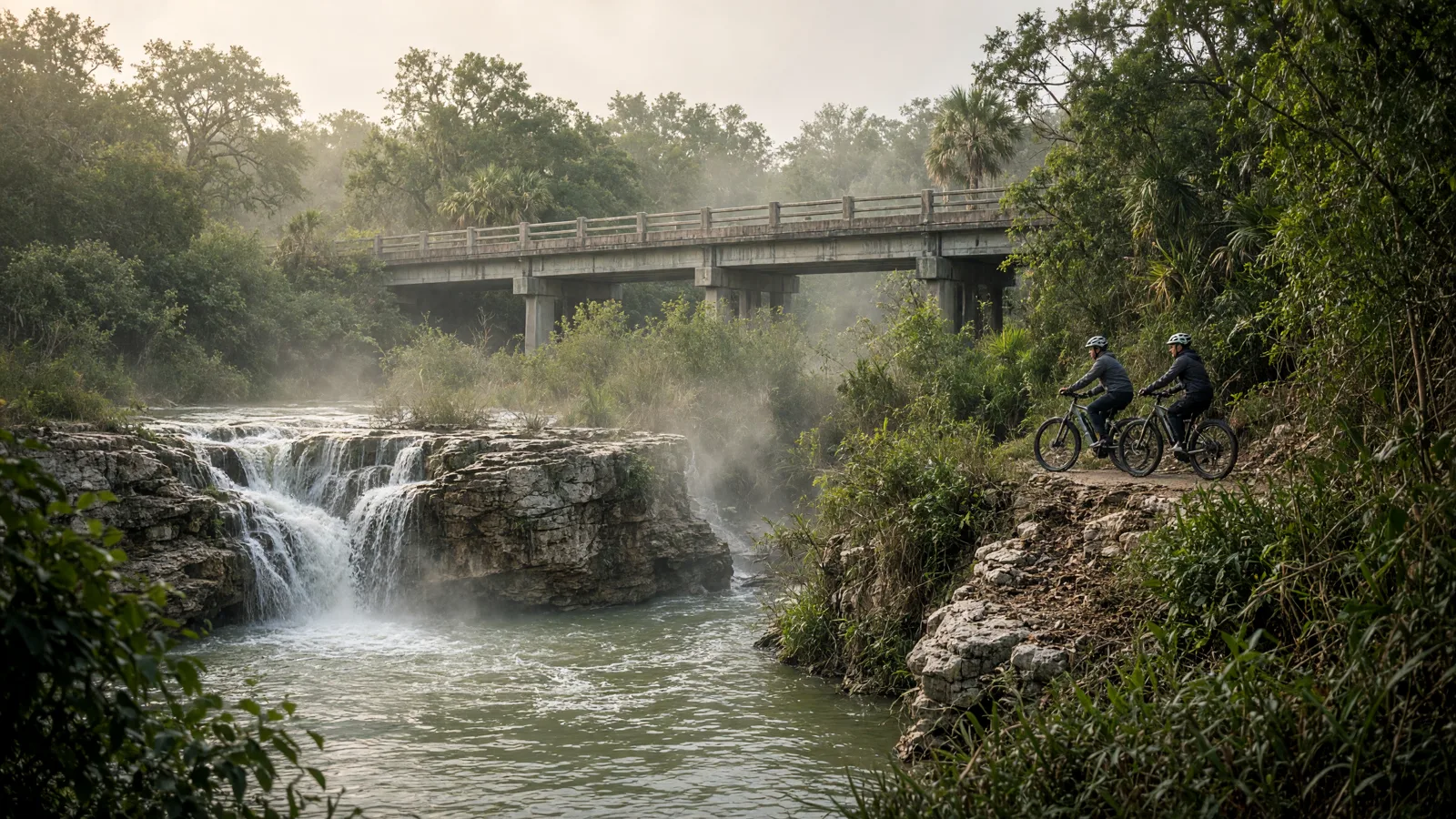
Things To Do on an eBike in Cameron County, TX
Cameron County riding splits into three types. In Brownsville and Harlingen you find long paved rail-trail and arroyo corridors. In Harlingen and at Benavides Park you find natural-surface mountain bike loops. County-wide, the Caracara Trails project links these routes into one network, according to Rails to Trails.
No official eBike rule page is published for these routes, so Texas state law is the default. Distances conflict on several trails, and both numbers are included. Where a detail is not published, check the manager's map or posted signs for final answers on closures, surfaces and rules.
Where to ride in Cameron County
The routes sit in three places. Brownsville holds the Historic Battlefield Trail, run by Brownsville Parks and Recreation, and the Benavides MTB Trails, run by Cameron County Parks & Recreation. Harlingen holds the Arroyo Colorado trail and the Henry Roberts Loop, both tied to the City of Harlingen. The Meg Jorn Trail has no manager named in its source.
By length, the Historic Battlefield Trail is longest at 10.1 miles per TrailLink or 8.5 per Rails to Trails. The Arroyo Colorado trail is 4.6 miles per TrailLink or 3.7 per AllTrails. The Meg Jorn Trail is 4.1 miles. All three are listed as asphalt, two with boardwalk. The mountain bike loops are natural-surface, where Texas lets managers ban eBikes. No route has a published eBike rule.
eBike shop hubs
Ready to rent, buy or get a battery checked? Pick a city below to see the local shop cards, starting with Brownsville and its 7 listings.
- eBike shops in Port Isabel
- eBike shops in Brownsville
- eBike shops in South Padre Island
- eBike shops in Harlingen
- eBike shops in La Feria
Rental and tour contacts
Rental cards for the county include Speedy Rentals and SPI Activities. Hours, prices and bike types are not published here, so call to ask whether eBikes are available and what the rental terms are.
SPI Activities🚲 Rentals
Speedy Rentals🚲 Rentals

Named eBike routes and access checks
1. Historic Battlefield Trail: Brownsville's rail-trail
This is the longest paved route in the county. TrailLink describes it as a rail-trail of asphalt and boardwalk. It runs between E. Harrison St. and Los Fresnos Nature Park, with a trailhead at Southern Pacific Linear Park on E. 6th Street. Rails to Trails describes the ends differently, near River Levee Road and W. University Blvd and Palo Alto Battlefield entrance, and gives 8.5 miles. TrailLink gives 10.1 miles. Both are secondary sources, so treat the length as approximate. Brownsville Parks and Recreation runs the trail website. The trail is part of Caracara Trails. Rails to Trails also mentions a planned B-Cycle bike-share launch in Brownsville, which is not an eBike rule.
Distance: 10.1 miles per TrailLink, or 8.5 miles per Rails to Trails; start: Southern Pacific Linear Park at E. 6th Street; surface: Historic Battlefield Trail: asphalt and boardwalk, per TrailLink.
eBike access: No eBike rule specific to this trail is published, so Texas law applies: eBikes are allowed wherever regular bicycles are. Check posted signs for any local limit. Etiquette and planning: Slow down on boardwalk sections and at road crossings. Pass on the left with a call out. Check the manager page for closures before a long ride. Managing source: Rails to Trails, Historic Battlefield Trail.
2. Arroyo Colorado Hike & Bike Trail: Harlingen along the water
This paved trail is in Harlingen. TrailLink lists asphalt and boardwalk, with trailheads at McKelvey Park, 1325 S 77 Sunshine Strip, and at Dixieland Rd. VORBA lists the City of Harlingen Parks and Recreation Department as land owner. Length is in conflict: TrailLink says 4.6 miles and AllTrails lists a 3.7-mile out-and-back. A TrailLink review says someone rode an eBike here and that the trail can flood, so check conditions after heavy rain. The paved Arroyo trail also connects Arroyo Park, McKelvey Park, C.B. Woods Park and Dixieland Park, which is how many riders reach the nearby mountain bike loops.
Distance: 4.6 miles per TrailLink, or a 3.7-mile out-and-back per AllTrails; start: McKelvey Park, 1325 S 77 Sunshine Strip, Harlingen, or Dixieland Rd; surface: Arroyo Colorado Hike & Bike Trail: asphalt and boardwalk, per TrailLink.
eBike access: No eBike rule is published for this trail, so Texas law applies. Watch for signs from the City of Harlingen, which can post its own limits such as speed. Etiquette and planning: Expect walkers and families near the parks. Stay right, keep speed low on the boardwalk, and skip the trail after heavy rain when it can flood. Managing source: VORBA, Rio Grande Valley trail list (Harlingen Parks and Recreation).
3. Meg Jorn Trail, short asphalt link between nature parks
The Meg Jorn Trail is a 4.1-mile asphalt trail, according to TrailLink. It runs between Hugh Ramsey Nature Park and Rio Hondo Rd. It opened in 2015 as the 25th Street Hike and Bike Trail and was renamed in 2018. That history matters if you search maps, since older listings may use the earlier name. The source does not state a managing agency, and no other source here names one. Riders should look for a manager sign at the trailhead. It is a good fit for a shorter ride on a paved surface.
Distance: 4.1 miles, per TrailLink; start: Hugh Ramsey Nature Park or Rio Hondo Rd; surface: Asphalt, per TrailLink.
eBike access: No eBike rule is published for this trail, and the manager is not named. Texas law applies, so eBikes are allowed wherever regular bicycles are, and read posted signs. Etiquette and planning: Treat nature park entrances as slow zones. Give walkers room, and confirm the manager and any closures at the trailhead before riding. Managing source: TrailLink, Meg Jorn Trail.
4. Henry Roberts Loop: Harlingen singletrack with a skills area
This loop is part of the Harlingen Arroyo Hike and Bike Trails. VORBA lists it at about 2.5 miles, mostly green with some blue features, plus a developing mountain bike skills section called The Hub. The City of Harlingen Parks and Recreation Department is listed as land owner. The same VORBA page also gives about 5.1 miles for the Henry Roberts Loop and The Thicket together, which conflicts with its separate figures of 2.5 and 2.6 miles. Reach it by the paved connector from Arroyo Park, McKelvey Park, C.B. Woods Park or Dixieland Park. The Thicket, about 2.6 miles, shares those access points.
Distance: About 2.5 miles per VORBA, which also lists a conflicting 5.1-mile combined total; start: Paved connector from Arroyo Park, McKelvey Park, C.B. Woods Park or Dixieland Park; surface: Natural-surface mountain bike trail, per VORBA; check the city page for current conditions.
eBike access: No eBike rule is published. Texas lets a local authority ban eBikes on natural-surface paths closed to motor vehicles, so read posted signs before entering. Etiquette and planning: Yield to riders going uphill and to walkers. Ride only dry trails, and slow down at blind turns and near the skills section. Managing source: VORBA, Rio Grande Valley trail list (Harlingen Parks and Recreation).
5. Benavides MTB Trails, county park trails in Brownsville
These trails are at Benavides Park, 2055 S. Browne Road, Brownsville. VORBA lists Cameron County Parks & Recreation as the manager and describes about 3.2 miles of multi-use trail, mostly green with intermediate wood features and two dirt pump track areas. MyRGV news reported a 2.5-mile mountain bike trail and exercise court with beginner, intermediate and advanced levels. That is a conflict, so use either number loosely. The surface is not stated as paved, so assume dirt. Check the county park page for hours and closures.
Distance: About 3.2 miles per VORBA, or 2.5 miles per MyRGV; start: Benavides Park, 2055 S. Browne Road, Brownsville; surface: Not stated as paved; VORBA mentions dirt pump track areas.
eBike access: No eBike rule is published. Texas lets a local authority ban eBikes on natural-surface paths closed to motor vehicles, so check posted county park signs first. Etiquette and planning: Keep speed down around the pump tracks and wood features. Yield to walkers and slower riders, and confirm park hours before you go. Managing source: Cameron County Parks & Recreation, Benavides Park.
6. Caracara Trails, the county network
Caracara Trails is a TrailNation project. Rails to Trails describes more than 428 miles of connected multiuse trails, paddling trails and bicycle routes in Cameron County. The Historic Battlefield Trail is part of it, according to TrailLink. No single manager is named, so each segment has its own owner, such as a city or the county. Use the network as a planning map, not as one trail. Check each segment's manager for surface, hours and rules before you ride, since some parts may be unfinished or differ in surface.
Distance: More than 428 miles of connected routes across the county, per Rails to Trails; start: Several access points; check the manager map; surface: Check the manager page for current surface.
eBike access: No eBike rule is published for the network as a whole. Texas law applies, and each segment's manager may post its own limits, so read the signs. Etiquette and planning: Plan by segment, carry a charger plan and water, tell someone your route, and confirm each manager's closures before heading out. Managing source: Rails to Trails, Connecting the Lower Rio Grande Valley by trail.
Planning a Cameron County ride
No charging locations are published for these routes. Charge your battery fully at home or at your lodging before you go. The paved trails are listed at 4.1 to 10.1 miles, so most riders can finish a one-way trip with a normal battery, but plan for the return. Carry water, and ask a listed shop about battery checks if yours is aging.
Crowds, closures and transit details are not published for these routes. The Arroyo Colorado trail can flood, per a TrailLink review, so check conditions after rain. Rails to Trails mentions a planned B-Cycle bike-share in Brownsville, but no launch date is given. Check each manager's page and the posted signs at trailheads for closures.
Half-day and full-day eBike plans
Half day: Ride the Arroyo Colorado Hike & Bike Trail in Harlingen. Start at McKelvey Park and ride the 4.6 miles, per TrailLink, or the 3.7-mile out-and-back AllTrails lists. It is paved, so it suits most bikes. Add the paved connector to Dixieland Park if you want more distance, and plan the return leg.
Full day: Spend the morning on the Historic Battlefield Trail from Southern Pacific Linear Park at E. 6th Street. Ride as far as your battery allows, since sources list 8.5 to 10.1 miles. After a break, add the Meg Jorn Trail at 4.1 miles if you have energy and charge left.
Rainy-season backup: If the Arroyo trail looks wet, choose the Meg Jorn Trail or a section of the Historic Battlefield Trail. Both are listed as asphalt. Skip natural-surface loops like Henry Roberts and Benavides after rain, and check posted signs before you start.
What not to ride in Cameron County
Natural-surface trails with a posted ban: Texas lets a local authority ban eBikes on natural-surface paths closed to motor vehicles. Henry Roberts Loop, The Thicket and Benavides MTB Trails may fall in that group. No ban is published, but a trailhead sign decides. If one is posted, walk or park the bike.
Boardwalk sections: The Historic Battlefield and Arroyo Colorado trails both include boardwalk, per TrailLink. No rule bans eBikes there, but boards are narrow and can be slick. Slow to walking pace, and dismount if the sign or crowd calls for it.
Flooded trail segments: A TrailLink review says the Arroyo Colorado trail can flood. Do not ride through standing water. It hides damage to the surface and can harm a motor or battery. Wait until the trail clears or choose another route.
Sidewalks: No county or city sidewalk eBike rule is published. Texas allows local authorities to prohibit bicycles on sidewalks, so signs may differ in town. When in doubt, stay in the street or on the trail, and give pedestrians room.
When to ride Cameron County
Cameron County is in far South Texas, so summers are hot and humid. Early morning and evening rides are usually the most comfortable, and water matters on exposed trails. Heavy rain can flood trails, such as the Arroyo Colorado trail, so check conditions first. Trail hours and seasonal closures are not published here, so use the manager map or posted signs. Weekends near parks and the coast may be busier, though no crowd figures are published.
Texas eBike laws and route permission
Texas defines an eBike in Transportation Code 664.001. It must have fully operable pedals and a motor under 750 watts, with a top assisted speed of 28 mph or less. Class 1 is pedal-assist only and stops assisting at 20 mph. Class 2 can move the bike without pedaling, also up to 20 mph. Class 3 is pedal-assist that goes past 20 mph but stays under 28 mph. Section 541.201 says an eBike is not a motor vehicle, which is why car rules do not apply to it.
Under Transportation Code 551.106, TxDOT or a local authority may not ban eBikes on a highway used mainly by motor vehicles, or anywhere regular bicycles are allowed. The exception is a path closed to motor vehicles with a natural-surface tread, meaning cleared or graded native soil with no surfacing. Those managers may restrict eBikes there. Local authorities may also prohibit bicycles on sidewalks and set bicycle speed limits on paths. A Class 3 rider must be at least 15, though a passenger under 15 is allowed. The law has no age minimum for Class 1 or Class 2. Bills HB 4089 and SB 1865 in 2025 were left pending, so nothing changed.
Texas has no statewide helmet law for eBike riders. Local rules or a trail manager may still ask for one, and wearing one is smart on any eBike. Under Section 551.107, Subtitles A, B, and D of the Transportation Code do not apply, so there is no driver license, vehicle registration, or similar requirement for these bikes. The motor must stop assisting when you quit pedaling or squeeze the brakes. Check your county or city for local rules before you ride. For a fuller walkthrough, read our guide to Texas eBike laws.
Trail access in Texas depends on who manages the path. A city, county, or park manager can decide whether eBikes are allowed on a path closed to motor vehicles that has a natural-surface tread, which means cleared or graded native soil with no surfacing. Paved paths and any place regular bicycles may go are different, because the state bars local authorities from banning eBikes there. Before you head out, check the posted rules for the specific trail or park, since the dirt singletrack is where a ban is most likely.
Managers can also set bicycle speed limits on paths, so slow down where signs say so. Class matters too: Class 1 and Class 2 stop assisting at 20 mph, while Class 3 goes higher, and a Class 3 rider must be at least 15. The motor must cut out when you stop pedaling or brake. Ask the park office or check the trail website if the rules are unclear. This page does not list trail-specific limits, because those are set locally.
No Cameron County, Brownsville or Harlingen eBike ordinance is published for the routes in this guide, and Texas law applies. Local authorities cannot prohibit eBikes on highways used mainly by motor vehicles or wherever regular bicycles are allowed, except on natural-surface paths closed to motor vehicles. They may set bicycle speed limits on paths.
Managers differ by route: Brownsville Parks and Recreation runs the Historic Battlefield Trail website, and Cameron County Parks & Recreation manages Benavides Park. The City of Harlingen is listed as land owner of the Arroyo trails. The Meg Jorn Trail has no named manager, and Caracara Trails has no single one. Posted signs from any manager override assumptions.
Source conflicts are plain: the Historic Battlefield Trail is 10.1 miles per TrailLink and 8.5 per Rails to Trails. The Arroyo Colorado trail is 4.6 miles per TrailLink and 3.7 per AllTrails. Benavides is 3.2 per VORBA and 2.5 per MyRGV. No pending eBike rule change with a date is published. The Brownsville B-Cycle bike-share is not an eBike rule. Read the Texas eBike laws.
Frequently asked questions
Which Cameron County trail is longest?
The Historic Battlefield Trail in Brownsville is longest, but sources disagree. TrailLink lists 10.1 miles and Rails to Trails lists 8.5. The ends are also described differently. Plan for the shorter number and treat the extra distance as a bonus, then check the manager map.
Is the Arroyo Colorado trail paved?
Yes, TrailLink lists asphalt and boardwalk. It runs in Harlingen with trailheads at McKelvey Park and Dixieland Rd. Length is 4.6 miles per TrailLink and 3.7 miles per AllTrails. A review says it can flood, so check conditions after rain.
Where is the Meg Jorn Trail?
It runs between Hugh Ramsey Nature Park and Rio Hondo Rd, per TrailLink, for 4.1 miles of asphalt. It opened in 2015 as the 25th Street Hike and Bike Trail and was renamed in 2018. The source does not name its manager.
Can I ride an eBike on mountain bike trails in Harlingen?
No eBike rule is published for the Henry Roberts Loop or The Thicket. Texas lets managers ban eBikes on natural-surface paths closed to motor vehicles. The City of Harlingen is listed as land owner, so read trailhead signs before riding.
How long is the Benavides trail system?
VORBA lists about 3.2 miles of multi-use trail at 2055 S. Browne Road in Brownsville. MyRGV reported 2.5 miles. The two sources conflict, so use the figures loosely. Cameron County Parks & Recreation is listed as manager.
What is Caracara Trails?
Rails to Trails describes Caracara Trails as a TrailNation project with more than 428 miles of connected multiuse trails, paddling trails and bicycle routes in Cameron County. The Historic Battlefield Trail is part of it. It has no single named manager, so check each segment.
Do I need a helmet on a Cameron County trail?
Texas has no statewide helmet law, and no local helmet rule is published for these routes. Wearing one is still smart, especially on natural-surface trails and boardwalk. A park manager may post its own requirement, so read signs.
Are the trails open to Class 3 eBikes?
No rule specific to Class 3 is published for these routes. Texas allows Class 3 operators who are at least 15, with assisted speed over 20 and below 28 mph. Managers may set bicycle speed limits on paths, so watch for posted speeds.
All eBike shops in Cameron County
Need a bike, rental or repair before you ride? Browse all Cameron County eBike shops by city and compare categories.