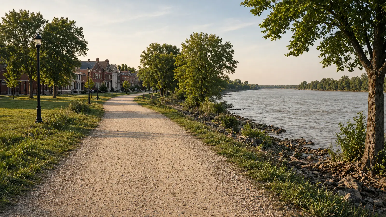
Things To Do on an eBike in St. Charles County, MO
St Charles County riding centers on paved greenways that connect to the Katy Trail. Boschert Greenway is 5.44 miles, Busch Greenway is 4.72 miles and Centennial Greenway is 3.88 miles. Dardenne Greenway Trail adds segments of 2, 4 and 7 miles. Most are flat and open to the sun.
This guide covers each route's length, surface, trailhead and manager. It also covers the eBike rule on each. Great Rivers Greenway recommendations allow Class 1 and Class 2 eBikes unless signs say otherwise. Where a rule is not published, this guide says so and sends you to the manager map or the posted signs.
Where to ride in St Charles County
The routes are spread across St Charles, St. Peters and the Busch area, and most link to the Katy Trail. Boschert starts at the Katy Trail off Olive Street. Busch starts at Katy Trail mile marker 52.1. Centennial starts near Highway 364 and Upper Bottom Road in St. Peters. Dardenne Greenway Trail has trailheads at Legacy Park, St. Charles Community College, Woodlands Sports Park, Rabbit Run Park and Dardenne Park. Hamburg Trail meets the Katy Trail at mile marker 56.
Boschert is the longest paved single route at 5.44 miles, followed by Busch at 4.72 and Centennial at 3.88 miles of asphalt. Dardenne is the most flexible, with 2, 4 and 7 mile segments on asphalt separated from the road. Hamburg Trail is gravel and not road-bike friendly. Great Rivers Greenway recommendations allow Class 1 and Class 2 on the greenways unless posted. Boschert, Busch and Centennial each have more than one manager, so signs may differ.
eBike shop hubs
Need a shop before you ride? These city pages list the eBike and bicycle shops near each route, starting with St Charles, which has the most listings.
Rental and tour contacts
Bike Stop Outpost is listed as a bicycle rental service. Its hours, rental terms and eBike availability are not published, so call before planning a ride around a rental.
Bike Stop Outpost🚲 Rentals

Named eBike routes and access checks
1. Boschert Greenway, flat, paved and tied to the Katy Trail
Boschert Greenway is the easiest place to start. It is paved, mostly flat and sunny, which suits a first eBike ride but means little shade in July and August. It begins at the Katy Trail off Olive Street and ends near Fox Hill Park at Fox Hill Road. It is managed in cooperation with the City of St. Charles Parks Department. A direct link goes over the 370 Discovery Bridge to the Missouri Greenway: Earth City Levee, though that trail's length, surface and trailhead are not published. Great Rivers Greenway recommends a 12 mph design speed. Many partners set 15 mph, and some set 10 mph where traffic is greater. No Boschert-specific eBike rule was found, so follow signs at each end.
Distance: 5.44 miles, per Great Rivers Greenway; start: Katy Trail off Olive Street, or Fox Hill Park near Fox Hill Road; surface: Paved, mostly flat and sunny.
eBike access: No trail-specific eBike rule was found. Great Rivers Greenway recommendations allow Class 1 and Class 2 eBikes unless posted otherwise. Etiquette and planning: Keep to the recommended 12 to 15 mph, slow to 10 mph where traffic is greater, pass with a call, and carry water because shade is limited. Managing source: Great Rivers Greenway, Boschert Greenway.
2. Busch Greenway: Katy Trail to the conservation area
Busch Greenway runs from the Katy Trail to the Missouri Research Park and on to the August A. Busch Conservation Area, and it is paved. Four agencies manage it: St. Charles County Parks, the St. Charles County Highway Department, the University of Missouri and the Missouri Department of Conservation. That mix means rules and signs can change as you move along the route. The trailhead is at Katy Trail mile marker 52.1. Busch also forms part of a 13.1-mile loop with the Hamburg Trail and the Katy Trail. The manager page lists no eBike rule, so the Missouri default applies.
Distance: 4.72 miles, per Great Rivers Greenway; start: Katy Trail mile marker 52.1; surface: Paved.
eBike access: Busch Greenway: no eBike rule is listed on the manager page, so Missouri law applies. Great Rivers Greenway recommendations allow Class 1 and Class 2 unless posted otherwise. Etiquette and planning: Watch for signs when management changes, especially near conservation land. Check the manager map for closures and ask about Class 3 before you ride. Managing source: Great Rivers Greenway, Busch Greenway.
3. Centennial Greenway: St. Peters to Schaefer Park
Centennial Greenway starts on the Katy Trail near Highway 364 and Upper Bottom Road in St. Peters. It continues toward Schaefer Park and connects to Spencer Creek Trail at McClay Road, and the surface is asphalt. Management is shared by St. Charles County Parks, the City of St. Charles Parks Department, MoDOT and the City of St. Peters. Spencer Creek Trail's length, surface and manager are not published, so confirm them before you count on it. The same Great Rivers Greenway page also lists the Creve Coeur Connector, a 4.7-mile paved trail with a separated bike lane on the Page Avenue Extension Bridge, but its manager and trailhead are not stated. The manager page lists no eBike rule.
Distance: 3.88 miles, per Great Rivers Greenway; start: Katy Trail near Highway 364 and Upper Bottom Road in St. Peters; surface: Asphalt.
eBike access: Centennial Greenway: no eBike rule is listed on the manager page, so Missouri law applies. Great Rivers Greenway recommendations allow Class 1 and Class 2 unless posted otherwise. Etiquette and planning: Expect road crossings near the highway. Slow down at junctions such as McClay Road and check the manager map for the connecting trails. Managing source: St. Charles Parks, Centennial Greenway.
4. Dardenne Greenway Trail, pick a 2, 4 or 7 mile segment
Dardenne Greenway Trail is built in segments of 2, 4 and 7 miles. The asphalt surface is separated from the road, which helps new riders. Trailheads are at Legacy Park, St. Charles Community College, Woodlands Sports Park, Rabbit Run Park and Dardenne Park. That lets you choose a short out-and-back or a longer ride between parks. The published map does not name a managing agency, and no eBike rule is listed. In that case, Missouri law applies and you should follow the signs at each park. Because the agency is unclear, check the map and posted notices for closures before you ride.
Distance: Segments of 2, 4 and 7 miles, per the Great Rivers Greenway Dardenne map; start: Legacy Park, St. Charles Community College, Woodlands Sports Park, Rabbit Run Park or Dardenne Park; surface: Asphalt, separated from the road.
eBike access: No eBike rule is listed, so Missouri law applies. Follow posted signs at each park, since the managing agency is not stated. Etiquette and planning: Choose a segment that matches your battery range, pass walkers with a call, and watch for park traffic near each trailhead. Managing source: Great Rivers Greenway, Dardenne Greenway map.
5. Hamburg Trail, gravel link to the Katy Trail
Hamburg Trail is gravel and is described as not road-bike friendly. That matters for eBikes with narrow tires, so bring a bike with wider tires. It joins the Katy Trail at mile marker 56. It forms part of a 13.1-mile loop with Busch Greenway and the Katy Trail, which makes it useful if you want a longer day without repeating the same path. Its managing agency and trailhead are not stated in the published information, and no eBike rule was found. Missouri law applies by default. Check the manager map and signs, and expect rougher footing than on the paved greenways, especially after rain.
Distance: Length not published; it is part of a 13.1-mile loop with Busch Greenway and the Katy Trail, per Great Rivers Greenway; start: Several access points; check the manager map. It meets the Katy Trail at mile marker 56; surface: Gravel.
eBike access: No eBike rule was found, so Missouri law applies. Check posted signs, since the managing agency is not stated. Etiquette and planning: Ride slower on gravel, leave extra braking distance, and skip it on narrow road tires or when the surface is soft after rain. Managing source: Great Rivers Greenway, Busch Greenway page.
6. Katy Trail connections: Main Street and Frontier Park
The Katy Trail ties the county routes together. Boschert starts from it off Olive Street. Busch starts at mile marker 52.1. Hamburg Trail joins at mile marker 56, and Centennial starts near Highway 364 and Upper Bottom Road. The same pages describe connections to historic Main Street in St. Charles and to Frontier Park. The Katy Trail's managing agency, length, surface and trailhead are not stated in the information available for this guide, and no eBike rule was found. Treat it as a connector, and check the manager map and posted signs before relying on it for a long ride.
Distance: Length not published for the county section; mile markers 52.1 and 56 are referenced, per Great Rivers Greenway; start: Several access points; check the manager map. Mile markers 52.1 and 56 are named connections; surface: Check the manager page for current surface.
eBike access: No eBike rule was found, so Missouri law applies. Great Rivers Greenway recommendations allow Class 1 and Class 2 on its greenways unless posted. Etiquette and planning: Use mile markers to plan meeting points, slow down near Main Street and Frontier Park where foot traffic is heavier, and follow all posted signs. Managing source: Great Rivers Greenway, Busch Greenway page.
Planning a St Charles County ride
Charging locations are not published for these routes, so charge fully at home before you ride. Boschert, Busch and Centennial are each under 6 miles, so a standard battery should cover an out-and-back with room to spare. Dardenne's 7-mile segment is the longest published single stretch. Shade is limited on Boschert, so carry water, and check each manager page for closures before you leave.
No crowd or closure data is published for these routes, so check the manager map and posted notices on the day. Several greenways have more than one manager, and signs can differ between sections. Transit and ferry connections are not covered in the available information. Park at trailheads such as Fox Hill Park or Legacy Park, and call the shops listed for the county if you need a repair before a ride.
Half-day and full-day eBike plans
Half day: Ride Boschert Greenway from the Katy Trail off Olive Street to Fox Hill Park and back. That is about 10.9 miles round trip on a paved, mostly flat route. Bring water because shade is limited. Finish with a short look at Main Street in St. Charles via the Katy Trail connection.
Full day: Start at Katy Trail mile marker 52.1 and ride Busch Greenway, 4.72 miles, then turn to the 13.1-mile loop with Hamburg Trail and the Katy Trail if your tires suit gravel. Add Centennial Greenway, 3.88 miles, if your battery allows. Check signs where managers change.
With kids: Pick a Dardenne Greenway Trail segment of 2 or 4 miles from a park trailhead such as Legacy Park or Rabbit Run Park. The asphalt is separated from the road. Keep speeds low, and remember a Class 3 eBike requires a rider at least 16.
What not to ride in St Charles County
Hamburg Trail on narrow tires: Hamburg Trail is gravel and is described as not road-bike friendly. A light eBike with narrow road tires is a poor match, especially when the surface is soft. Use Busch or Boschert instead, or bring a bike with wider tires.
Class 3 eBikes on greenways: Great Rivers Greenway recommendations name Class 1 and Class 2 as allowed unless posted otherwise. They do not clearly allow Class 3. A 28 mph eBike is also a poor fit for paths with a 12 to 15 mph recommended speed. Check signs before riding one.
Anywhere signs say no: Great Rivers Greenway recommendations allow Class 1 and Class 2 only unless posted otherwise. Local and trail rules can restrict classes or require helmets. If a sign at a trailhead or park limits eBikes, follow the sign over any general guidance.
Unknown sections with no published rule: Spencer Creek Trail, the Creve Coeur Connector and the Earth City Levee link have no published manager, surface or eBike rule in the available information. Do not assume they are open to eBikes. Check the manager map first.
When to ride St Charles County
Boschert is mostly flat and sunny, so summer afternoons can feel hot, and the paved greenways have limited shade. Early morning or evening is usually more comfortable. Spring and fall are generally easier for longer rides, though weather varies. Gravel on Hamburg Trail can be soft after rain. Hours, seasonal closures and crowd levels are not published for these routes, so check the manager map and posted signs before you go. Weekends on trails near parks and Main Street are likely to be busier.
Missouri eBike laws and route permission
Missouri defines an electric bicycle in RSMo 301.010 as a bike with fully operable pedals, a saddle and an electric motor under 750 watts. A 2025 law added a three-class system. Class 1 is pedal assist only, and the motor stops helping at 20 mph. Class 2 may move the bike without pedaling, and its motor also stops at 20 mph. Class 3 is pedal assist only and stops at 28 mph. Under RSMo 307.194, the manufacturer must label the bike with its class.
Under RSMo 307.194, eBikes that meet the definition have the rights and duties of bicycles. The statute summary we rely on does not address sidewalks, so check local rules before riding on one. Age limits apply to Class 3. The operator must be at least 16. Anyone under 16 may ride a Class 3 only as a passenger, and only on one designed for passengers. Local and trail rules can restrict eBike classes. The most recent change is the 2025 law that created the three classes.
Missouri has no statewide helmet law for eBike riders. Local rules and trail rules can still require a helmet, so check the rules where you ride. Missouri does not require a license, registration or insurance for an eBike that fits the definition. A Class 3 must have a speedometer that shows mph. For a plain-language rundown, see our guide to Missouri eBike laws.
Statewide law gives compliant eBikes the rights and duties of bicycles, but it does not settle every trail. Local and trail rules can restrict classes or require helmets. That means the people who run a given trail or park can set the terms for your ride. The statute summary we use does not cover natural-surface trails or park-specific limits, so check with the trail manager before you go.
Know your class before you head out. The manufacturer's class label tells you which one you have, and rules that restrict classes will refer to it. Class 1 and Class 2 stop assisting at 20 mph. Class 3 stops at 28 mph and must have a speedometer showing mph. Riders under 16 cannot operate a Class 3. Keep the label intact and legible, since it is how you show your bike's class.
No St. Charles County or major-city eBike ordinance was found. The county parks site lists more than 50 miles of trails in three types: multi-use, natural surface and paved. It gives no eBike rule. That means Missouri law applies by default on most routes, and the manager of each trail can post its own limits.
Great Rivers Greenway recommendations allow Class 1 and Class 2 eBikes unless posted otherwise. It recommends a 12 mph design speed. Many partners set 15 mph, and some set 10 mph where traffic is greater. These are recommendations, not county law, so signs at each trailhead take priority.
One source conflict matters, and Great Rivers Greenway's usage page says Class 3 eBikes require a motor vehicle license. Missouri's RSMo 307.194 says compliant eBikes need no license, registration or insurance, and sets a minimum age of 16 for Class 3 operators, so ask the trail manager. No pending eBike changes with dates were found.
Frequently asked questions
Where does Boschert Greenway start and end?
Boschert Greenway has trailheads at the Katy Trail off Olive Street and at Fox Hill Park near Fox Hill Road. It is 5.44 paved miles, mostly flat and sunny, managed in cooperation with the City of St. Charles Parks Department.
How long is the Busch Greenway loop with Hamburg Trail?
Busch Greenway is 4.72 miles. It forms part of a 13.1-mile loop with Hamburg Trail and the Katy Trail. Hamburg Trail is gravel and meets the Katy Trail at mile marker 56, so bring a bike with tires suited to gravel.
Who manages Centennial Greenway?
Four agencies share it: St. Charles County Parks, the City of St. Charles Parks Department, MoDOT and the City of St. Peters. The greenway is 3.88 miles of asphalt, starting on the Katy Trail near Highway 364 and Upper Bottom Road.
Can I ride a throttle eBike on these routes?
Class 2 eBikes can run on a throttle. Great Rivers Greenway recommendations allow Class 1 and Class 2 on its greenways unless posted otherwise. No route has a published ban on throttles, but check signs at each trailhead.
What is the top speed I should ride?
Class 1 and 2 stop assisting at 20 mph. Class 3 reaches 28 mph. Great Rivers Greenway recommends a 12 mph design speed, and many partners set 15 mph. Slow to 10 mph where traffic is greater.
Which trail has the most flexible length?
Dardenne Greenway Trail comes in segments of 2, 4 and 7 miles, with trailheads at Legacy Park, St. Charles Community College, Woodlands Sports Park, Rabbit Run Park and Dardenne Park. You can pick a segment to fit your battery.
Are electric scooters allowed on the greenways?
The usage page covers electric personal assistive mobility devices. They may operate on streets, sidewalks and bicycle paths, only on roadways with a speed limit of 45 mph or less, and riders under 16 may not operate them except with a mobility-related disability.
Is there a connection to Main Street in St. Charles?
Yes, Great Rivers Greenway pages describe Katy Trail connections to historic Main Street in St. Charles and to Frontier Park. The Katy Trail's own length, surface and manager are not published, so check the manager map and signs.
All eBike shops in St Charles County
Looking for a shop, repair or rental before you ride? Browse all St Charles County eBike shops, grouped by city.