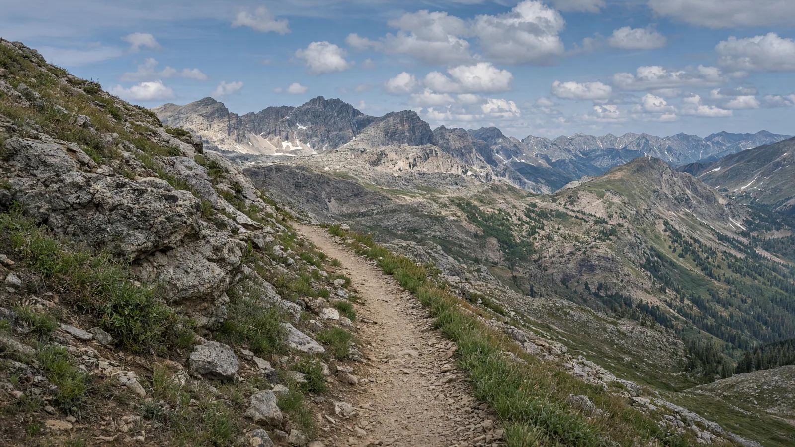
Things To Do on an eBike in Mesa County, CO
Mesa County riding splits into two kinds. The Colorado Riverfront Trail is long, paved and flat, and it links Fruita, Grand Junction and Palisade. Dirt routes such as the Palisade Rim Trail and Coal Canyon are for riders who want climbing and rough ground.
This guide covers six routes, including who manages them, the surface, the trailhead and the eBike rule. Where a manager has not posted an eBike rule, the Colorado state rules apply. Details such as lengths and surfaces come from the agencies and trail groups named in each entry. Where a detail is not published, check the manager map or posted signs.
Where to ride in Mesa County
The county sits in western Colorado along the Colorado River. Fruita is at the west end of the Riverfront Trail, and Palisade is at the east end. Grand Junction is between them and has most of the shops. The Palisade Rim Trail starts east of Palisade near US 6 and I-70. Coal Canyon starts at Exit 46 off I-70.
The Colorado Riverfront Trail is the longest at 28.3 miles, and it is asphalt and concrete. The Palisade Rim Trail is 8.7 miles with 1,324 feet of climbing, and it is rated intermediate to advanced. Coal Canyon is 4.9 miles out and back. None of the three has a posted eBike rule in the manager pages, so the state classes apply. One Riverfront bans motorized vehicles on its trails, so look for signs. Connected Lakes needs a state parks fee.
eBike shop hubs
Shops are listed by city. Grand Junction has the most, and Palisade and Fruita sit at the two ends of the Riverfront Trail. Pick the city nearest your route.
Rental and tour contacts
Palisade Bike Rentals is the rental business listed for the county. Rental terms, eBike availability and hours are not published here, so contact the business before you plan a ride around it.
Palisade Bike Rentals🚲 Rentals

Named eBike routes and access checks
1. Colorado Riverfront Trail, paved spine of the valley
The Colorado Riverfront Trail follows the Colorado River through Fruita, Grand Junction and Palisade. The Colorado Riverfront Commission manages it. Mesa County and Grand Junction set up the commission in 1987. Maintenance is split among Grand Junction, Mesa County, the City of Fruita and Colorado Parks and Wildlife. The trail is made up of named sections, including the Audubon Trail, Blue Heron Trail, Riverside Park, Watson Island and the Palisade Trail section. Two stretches are not dedicated trail: the west end of Riverbend Park in Palisade at 36 1/4 Road to 33 1/2 Road in Grand Junction, and 29 Road to 27 1/2 Road. A news report from summer 2025 called the trail nearly complete, with the Clifton to Palisade link as the final section. Check the manager map for current gaps.
Distance: 28.3 miles, per TrailLink, and described elsewhere as a 28-mile paved trail; start: Hawkeye Rd in Fruita and Brentwood Dr in Palisade are the endpoints; surface: Asphalt and concrete.
eBike access: No eBike rule is published on the manager pages, so state rules apply. Class 1 and 2 are allowed where bicycles are authorized. Class 3 is not unless the local authority permits it. One Riverfront bans motorized vehicles. Etiquette and planning: Wear a helmet, keep pets on a handheld leash and announce yourself when passing. No alcohol, fires, camping or fireworks. AllTrails reviewers mention fast eBikes as a problem. Managing source: Mesa County Parks, Riverfront Trail.
2. Riverfront Trail near Grand Junction, short out and back
For a shorter ride, AllTrails lists a 10.8-mile out-and-back version of the Riverfront Trail near Grand Junction. It is described as generally easy and 100% paved. That makes it a fit for newer riders, for a first eBike test ride or for a break from the longer sections. AllTrails lists January through November as the best time to ride. The listed challenges are fast eBikes and cyclists who do not announce themselves. This is a user-posted route on the same trail, so the manager and rules are the same as for the full Colorado Riverfront Trail. Sections near town include Riverside Park and Las Colonias. The sources name these sections but give no separate length, trailhead or rule for them.
Distance: 10.8-mile out and back, per AllTrails; start: Riverfront Trail near Grand Junction: several access points; check the manager map; surface: Paved, per AllTrails.
eBike access: Same as the full Riverfront Trail. State rules apply, Class 1 and 2 are allowed where bicycles are authorized, and Class 3 is not unless the local authority permits it. Etiquette and planning: Call out before passing, keep your speed down near walkers, and expect fast eBike traffic. Keep to the right and pull off the trail to stop. Managing source: link 0.
3. Connected Lakes and Corn Lake, state park section
The James M. Robb Colorado River State Park sections, Connected Lakes and Corn Lake, are listed among the Riverfront Trail sections by Mesa County Parks. They are managed by Colorado Parks and Wildlife, and the fee rule differs from the rest of the trail. Colorado Parks and Wildlife does not consider Connected Lakes part of the Riverfront Trail. A day use fee of $4.00 per person, or an annual state parks pass, is required to enter. Trail users who pass through only as a thoroughfare are not required to pay. A CPW page says Class 1 and 2 eBikes are allowed on roadways, designated bike lanes and multi-use trails open to non-motorized biking in state parks. Older wording on some pages says Class 1 only. That is a conflict, so follow current CPW signs.
Distance: Length is not published; check the manager map; start: Connected Lakes and Corn Lake: several access points; check the manager map; surface: Connected Lakes and Corn Lake: check the manager page for current surface.
eBike access: Colorado Parks and Wildlife says Class 1 and 2 are allowed on roadways, bike lanes and multi-use trails in state parks. Older pages say Class 1 only, so check posted signs. Etiquette and planning: Carry your pass or pay the fee if you are stopping, not just passing through. Keep pets leashed and stay on open trails. Managing source: Colorado Parks and Wildlife, biking page.
4. Palisade Rim Trail, climbing above the river
The Palisade Rim Trail is the harder ride on this list. The trailhead is east of Palisade near the junction of US 6 and I-70, at the Colorado River Launch parking. The route runs 8.7 miles and climbs 1,324 feet. The Grand Valley Off-Road Cyclists' guide rates it intermediate to advanced. It is not described as paved. A motor helps with the climb, but the terrain is the limit, so only experienced mountain bikers should consider it. The guide does not name a land manager or give a surface. No eBike rule is published, so state rules apply. Do not assume your class is allowed on singletrack. Look at the trailhead signs and the land manager map before you ride.
Distance: 8.7 miles with 1,324 feet of elevation gain, per the Grand Valley Off-Road Cyclists (GVORC); start: Colorado River Launch parking, near US 6 and I-70 east of Palisade; surface: Not described as paved; check the manager page for current surface.
eBike access: No eBike rule is published for this route, so state rules apply. Check posted signs, because path and trail permissions depend on the land manager. Etiquette and planning: Ride the climb at a steady pace, yield to hikers and riders coming downhill, and carry water. Intermediate to advanced skills are expected. Managing source: link 0.
5. Coal Canyon, short desert out and back
Coal Canyon starts at Exit 46 off I-70. The route is 4.9 miles out and back, which makes it a short ride that fits into a morning. Riders can extend it by taking the Hoodoo Trail or a long wash behind Mount Garfield. The Grand Valley Off-Road Cyclists list the route, but the guide does not give a surface, a manager or a rule for eBikes. It is not described as paved, so plan on dirt. Because no rule is published, state rules apply. Check the trailhead signs for current land manager restrictions before you ride. If you extend the route, the added length and rules are not published, so read the signs at each junction.
Distance: 4.9 miles out and back, per the Grand Valley Off-Road Cyclists (GVORC); start: Coal Canyon trailhead at Exit 46 off I-70; surface: Coal Canyon: check the manager page for current surface.
eBike access: No eBike rule is published for this route, so state rules apply. Check posted signs for the land manager's current rules before riding. Etiquette and planning: Bring water and tell someone your plan. Stay on the established route, and read signs at junctions before you extend the ride. Managing source: link 0.
6. Fruita and east valley sections, named Riverfront segments
The Riverfront system has more named sections than most riders know. These include the Kokopelli Section, Little Salt Wash Section in Fruita, Monument View Section West and East, the Blue Heron-Audubon Section, the Lunch Loops Connector Trail (Monument Trail), the Riverside-Las Colonias Sections, the C 1/2 Road-Parks and Wildlife Section West and East, and the Clifton Nature Park and Trail Section. A trail group lists these names, but publishes no separate agency, length, surface, trailhead or eBike rule for them. Treat them as parts of the larger corridor managed under the Colorado Riverfront Commission. Check the manager map for each section before you ride, and look for posted signs. The state rules apply where no local rule is posted.
Distance: Individual section lengths are not published; the whole trail is 28.3 miles, per TrailLink; start: Fruita and east valley sections: several access points; check the manager map; surface: Fruita and east valley sections: check the manager page for current surface.
eBike access: No separate eBike rule is published for these sections, so state rules apply. Class 3 is not allowed on paths unless the local authority permits it. Etiquette and planning: Read signs at each section boundary, because the manager can change. Slow down at road crossings and give walkers room. Managing source: Mesa County Parks, Riverfront Trail.
Planning a Mesa County ride
Charging points, trail closures and shuttle service are not published for these routes. Bring a charged battery and a margin for the return, especially on the long Riverfront Trail. At 28.3 miles end to end, a full out and back can exceed many batteries. Plan a one-way ride with a ride back if you want the full length.
Crowd levels are not published. AllTrails reviewers describe fast eBikes and riders who do not announce themselves, so expect mixed speeds. Two stretches are not dedicated trail, so plan for road riding there. Check the manager map and posted signs for closures. Shops in the county can help with repairs, and the directory lists three repair shops.
Half-day and full-day eBike plans
Half day: Ride the 10.8-mile out-and-back Riverfront Trail near Grand Junction. It is paved and generally easy, per AllTrails. Start at a Grand Junction access point, ride out and back, and stop at Riverside Park or Las Colonias. Bring water and a helmet, and call out when passing.
Full day: Start at Hawkeye Rd in Fruita and ride the Colorado Riverfront Trail toward Palisade. The trail is 28.3 miles, so plan around battery range and the two gaps in dedicated trail. Arrange a ride back from Brentwood Dr in Palisade, or ride out and back in parts.
With kids: Stay on the paved Riverfront Trail near Grand Junction and keep to the shorter out-and-back stretch. It is described as generally easy and 100% paved. Check helmet needs, and remember that Class 3 eBikes are for riders 16 and older. Avoid the Palisade Rim Trail.
What not to ride in Mesa County
Class 3 on paths: Class 3 eBikes are not allowed on a bike or pedestrian path unless the path is in a street or highway or the local authority permits it. Riders under 16 may not ride Class 3. Choose Class 1 or 2 for the Riverfront Trail.
Connected Lakes without a pass: Colorado Parks and Wildlife does not count Connected Lakes as part of the Riverfront Trail. A $4.00 per person day use fee or annual pass is required to enter. Riders passing through only as a thoroughfare do not need to pay.
Gaps in the Riverfront Trail: Two stretches are not dedicated trail: the west end of Riverbend Park in Palisade at 36 1/4 Road to 33 1/2 Road, and 29 Road to 27 1/2 Road in Grand Junction. Plan for road riding there, and use caution with traffic.
Rim Trail for new riders: The Palisade Rim Trail is rated intermediate to advanced and climbs 1,324 feet over 8.7 miles. It is not described as paved. New riders and anyone with a heavy eBike should choose the paved Riverfront Trail instead.
When to ride Mesa County
The AllTrails listing for the paved Riverfront Trail gives January through November as the best months. The valley is a high desert, so summer afternoons can be hot, and early morning rides are the safer choice on the dirt routes. Weekend hours on the paved trail are likely to be busier. Exact crowd levels and trail hours are not published. Check the manager map and posted signs for closures. Carry water, especially on the Palisade Rim Trail and Coal Canyon, where shade is limited.
Colorado eBike laws and route permission
Colorado defines an electrical assisted bicycle in C.R.S. 42-1-102 as a two or three wheeled bike with fully operable pedals and an electric motor not over 750 watts, and there are three classes. Class 1 gives assist only while you pedal and stops assisting at 20 mph. Class 2 can assist without pedaling and also stops at 20 mph. Class 3 assists only while you pedal and stops at 28 mph. A bike that has been modified out of every class, or that is built or sold to be easily configured past the class limits, does not count as an e-bike.
Under C.R.S. 42-4-1412, e-bike riders have the same rights and duties as drivers, subject to local ordinances. Class 1 and 2 e-bikes may use a bike or pedestrian path where bicycles are authorized. A local authority may prohibit them there. Class 3 e-bikes are not allowed on those paths unless the path is within a street or highway or the local authority permits it. Riders under 16 may not ride Class 3, though they can be passengers on a bike designed for passengers. HB25-1197 was signed May 28, 2025 and took effect Aug 6, 2025. It adds seller disclosures and multiple mode e-bike rules. From Jan 1, 2027, multiple-mode labels must show the highest class or each class.
Colorado has no statewide helmet rule for Class 1 or 2 riders. Class 3 operators and passengers under 18 must wear a CPSC or ASTM bicycle helmet with a chin strap. Compliant e-bikes need no license or registration. Labels must show class, top assisted speed and wattage, and must be updated after any modification (C.R.S. 42-4-221). Under HB25-1197, falsely labeling a non-e-bike as an e-bike is a deceptive trade practice. For more detail, see our guide to Colorado eBike laws.
Trail access is decided locally. Under C.R.S. 42-4-111, local authorities may authorize or prohibit e-bikes on bike or pedestrian paths. So a path that allows Class 1 and 2 in one town can be closed to them in the next. Class 3 riders have it tighter, since they need the local authority's permission on most paths. Check the posted rules or the managing agency before you ride, and do not assume a state rule overrides a local sign.
State parks have their own rule. Colorado Parks and Wildlife says Class 1 and 2 e-bikes are allowed on roadways, designated bike lanes, and multi-use trails and other areas open to non-motorized biking. In State Wildlife Areas and State Trust Lands, e-bikes are limited to designated roads, camping and parking where motor vehicles are allowed. The information conflicts on one point: Jeffco and Lakewood pages still say Class 1 e-bikes are allowed in all state parks where bicycles are permitted, which is older wording than CPW's page. Follow CPW and keep your class label accurate too. A modified bike may not legally count as an e-bike.
No Mesa County or City of Grand Junction eBike ordinance, sidewalk rule or pending eBike change was found, and State law applies. Class 1 and 2 eBikes may use a bike or pedestrian path where bicycles are authorized, and a local authority may prohibit them. Class 3 is not allowed on a path unless it is within a street or highway or the local authority permits it. Riders under 16 may not ride Class 3, and Class 3 riders and passengers under 18 must wear a helmet.
One Riverfront's trail rules say no motorized vehicles, though motorized wheelchairs and other ADA-compliant powered conveyances are allowed. They also say to wear helmets on bicycles, keep pets on a handheld leash, and avoid alcohol, fires, camping, fireworks and littering. The rules do not say how they apply to eBikes, so treat posted signs as final.
State park rules conflict in wording. The Colorado Parks and Wildlife biking page says Class 1 and 2 eBikes are allowed on roadways, designated bike lanes and multi-use trails in state parks. Older Jeffco and Lakewood pages say Class 1 only. Follow the current CPW page and posted signs. One pending state change: from January 1, 2027, multiple-mode eBike labels must show the highest class or each class, under HB25-1197.
Frequently asked questions
How long is the Colorado Riverfront Trail?
TrailLink lists it at 28.3 miles, and other pages describe it as a 28-mile paved trail. The endpoints are Hawkeye Rd in Fruita and Brentwood Dr in Palisade. Two stretches are not dedicated trail, so the ride includes some road sections.
Who manages the Riverfront Trail?
The Colorado Riverfront Commission manages it. Mesa County and the City of Grand Junction established it in 1987. Maintenance is split among Grand Junction, Mesa County, the City of Fruita and Colorado Parks and Wildlife.
Is the Palisade Rim Trail good for eBikes?
It is 8.7 miles with 1,324 feet of climbing, rated intermediate to advanced, and not described as paved. No eBike rule is published, so state rules apply. Check posted signs, and only strong mountain bikers should try it.
Where is the Coal Canyon trailhead?
It is at Exit 46 off I-70. The route is 4.9 miles out and back. You can extend it by the Hoodoo Trail or a long wash behind Mount Garfield. No eBike rule is published, so check signs.
Do I pay to ride the Riverfront Trail?
No fee applies for the trail itself. Connected Lakes is different, and Colorado Parks and Wildlife says it is not part of the Riverfront Trail, so a $4.00 per person day fee or annual pass applies, except for riders passing through only as a thoroughfare.
Are motorized vehicles banned on the trail?
One Riverfront's trail rules say no motorized vehicles. They allow motorized wheelchairs and ADA-compliant powered conveyances. They do not say how this applies to eBikes. State rules allow Class 1 and 2 on paths where bicycles are authorized, so follow signs.
Can I ride Class 3 on the Riverfront Trail?
Not unless the local authority permits it. State law bars Class 3 from bike and pedestrian paths unless the path is in a street or highway or a local authority allows it. No such permission was found for this trail.
Is the trail finished?
A summer 2025 news report called the trail nearly complete. A 2024 agreement allowed property purchase to link Las Colonias Park and 29 Road. The missing link between Clifton and Palisade is the final section. Check the manager map for current status.
All eBike shops in Mesa County
Need a shop before you ride? See all Mesa County eBike shops.