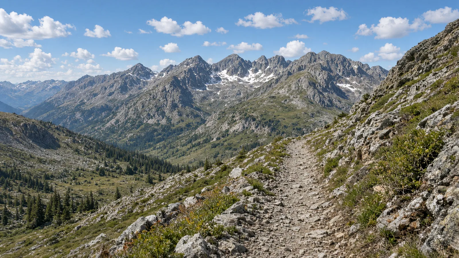
Things To Do on an eBike in Chaffee County, CO
Chaffee County riding runs from short paved paths in Salida to high Forest Service routes near Monarch Pass. This guide covers six routes with the length, surface, manager and e-bike rule for each. Where the published rule is missing, it says so. Where two sources disagree, both are named.
The easy rides are the Monarch Spur Trail and the Milk Run Trail in Salida. Buena Vista has the Midland Trail on an old railroad grade. The Monarch Crest, Rainbow Trail and Lenhardy Cutoff are longer and more remote. Plan battery, water and a way back before you commit to any of them.
Where to ride in Chaffee County
The routes cluster around three places. Salida has the Monarch Spur and Milk Run paths, both short and paved. Buena Vista has the Midland Trail, reached from Main Street or the Shield's Gulch trailhead. Poncha Springs is the last town before Highway 50 climbs 18 miles to Monarch Pass, where the Monarch Crest begins. The Rainbow Trail and Lenhardy Cutoff are longer routes, and their trailheads are mostly not published.
The Milk Run Trail is shortest at 0.5 miles of concrete. The Monarch Spur Trail is 2.5 miles per TrailLink and 2.6 per MTB Project, on concrete or paved path. The Midland Trail is 5.5 miles on an old railroad grade. The Monarch Crest is 11.5 miles, the Lenhardy Cutoff 15.7 and the Rainbow Trail 28. Only the Monarch Spur has a stated e-bike rule (allowed, per MTB Project). For the rest, the state default applies.
eBike shop hubs
Ready to rent or buy before you ride? These city pages list the shops, rental services and tour operator in each Chaffee County town.
Rental and tour contacts
Several listings are categorized as bicycle rental services or tour operators, including Mo Bike Rentals and The Bike Shack. Call to confirm that e-bikes are available, which class they are, and what the rental covers.
Epic Side X Side Rentals LLC🚲 Rentals
Mo Bike Rentals🚲 Rentals
The Bike Shack🚲 Rentals

Named eBike routes and access checks
1. Monarch Spur Trail, paved path through Salida
The Monarch Spur Trail is a short paved path in downtown Salida and the easiest route in the county for a first e-bike ride. It runs along an old spur corridor. The City of Salida is listed as manager by MTB Project, a secondary source, and length is a conflict. TrailLink says 2.5 miles, MTB Project says 2.6 miles, and AllTrails lists a 4.9-mile out-and-back with 173 feet of elevation gain. That difference most likely reflects one-way versus round-trip counting. Surface is concrete per TrailLink and paved path per MTB Project. The eastern end is near G Street and Sackett Avenue, and Holman Avenue crosses the trail. Expect walkers, dogs and other riders, so go at a speed that lets you stop.
Distance: 2.5 miles per TrailLink and 2.6 miles per MTB Project; AllTrails lists a 4.9-mile out-and-back; start: Eastern end near G Street and Sackett Avenue in downtown Salida, or at Holman Avenue where it meets the trail; surface: Concrete per TrailLink, paved path per MTB Project.
eBike access: MTB Project lists e-bikes as allowed and gives no class or speed limit. State law keeps Class 3 off bike paths unless the local authority permits it, so Class 3 riders should look for signs. Etiquette and planning: Keep to the right, pass slowly and announce yourself. Give walkers and dogs room, and use low assist near crossings such as Holman Avenue. Managing source: MTB Project, Monarch Spur Trail.
2. Milk Run Trail, half-mile concrete link
The Milk Run Trail is a very short concrete path in Salida. At 0.5 miles it is not a destination, but it is useful for a test ride on a new or rented e-bike, or as a flat warm-up before the longer rides. TrailLink lists it under the City of Salida trail system, a secondary source. Parking is available at the Walmart lot on US 50, which makes it easy to unload a bike and check the controls, brakes and battery. No e-bike rule specific to this path was found, so the state default applies. That default allows Class 1 and 2 on paths where bicycles are authorized, unless the local authority prohibits them. Read any signs at the entrance.
Distance: 0.5 miles, per TrailLink; start: Parking at the Walmart lot on US 50 in Salida; surface: Concrete, per TrailLink.
eBike access: No path-specific e-bike rule is published. State law applies: Class 1 and 2 where bicycles are authorized, and Class 3 only if the local authority permits it. Etiquette and planning: The path is short and shared, so keep speed low. Use the lot for test rides only if the store allows it, and respect store parking rules. Managing source: TrailLink, Milk Run Trail.
3. Monarch Crest (CDT #531), high singletrack from Monarch Pass
The Monarch Crest is the big ride in Chaffee County. The Continental Divide Trail #531 runs 11.5 miles from Monarch Pass to Marshall Pass, and the Salida Ranger District of the USDA Forest Service manages it. Phrase Guides lists a Monarch Crest Trail at 12 miles of single-track, and AllTrails calls it a heavily used mountain bike trail, so the lengths differ slightly between sources. To reach the start from Poncha Springs, drive west on Highway 50 for 18 miles to the top of Monarch Pass. The Forest Service page states that motorcycles are allowed and that ATVs and four-wheel-drive vehicles are prohibited. It does not state a surface or an e-bike rule. This is a remote high-elevation route, so check conditions first.
Distance: 11.5 miles from Monarch Pass to Marshall Pass, per the USDA Forest Service; Phrase Guides lists 12 miles; start: Monarch Crest at the summit of Monarch Pass, 18 miles west of Poncha Springs on Highway 50; surface: Single-track per Phrase Guides; the Forest Service page does not state a surface.
eBike access: No e-bike rule is published on the Forest Service page. State default applies, but confirm with the Salida Ranger District before riding. Motorcycles are allowed; ATVs and four-wheel-drive vehicles are not. Etiquette and planning: Carry spare battery range, water and layers, and plan your shuttle or return. Yield to hikers and horses, and stay on the trail. Managing source: USDA Forest Service, Continental Divide Trail #531 Monarch Crest.
4. Rainbow Trail, long singletrack off the Crest
The Rainbow Trail is the longest route in this guide. Phrase Guides lists it as 28 miles of single-track that connects from the Monarch Crest. That makes it a commitment, and an e-bike rider needs to think about battery range, water and exit points before starting. The managing agency is not stated in the material available, and the trailhead is not published either. That means you should check the manager map for the section you plan to ride and read the posted signs at each access point. No e-bike rule was found, so the state default applies, but land managers can set their own rules on trails they oversee. Treat this as a backcountry ride, not a casual outing.
Distance: 28 miles, per Phrase Guides; start: Trailhead not published; it connects from the Monarch Crest, so check the manager map; surface: Single-track, per Phrase Guides.
eBike access: No e-bike rule was found and the manager is not stated. State default applies; confirm with the land manager and posted signs before you ride. Etiquette and planning: Plan a bailout point, carry a charger or spare battery if you can, and yield to hikers and horses on narrow sections. Managing source: Phrase Guides, Salida trail list.
5. Midland Trail, railroad grade from Buena Vista
The Midland Trail follows an old railroad grade out of Buena Vista, which usually means steady, moderate gradients that suit an e-bike well. Phrase Guides lists it at 5.5 miles. One start is the Arkansas River footbridge at the east end of Buena Vista's Main Street, and the other is the Shield's Gulch trailhead. The managing agency is not stated in the material available, and no e-bike rule was found, so the state default applies. The surface is described only as an old railroad grade, so conditions may vary and it is worth asking a Buena Vista shop about current state. It is a sensible middle option between the paved Salida paths and the high-country routes.
Distance: 5.5 miles, per Phrase Guides; start: Arkansas River footbridge at the east end of Buena Vista's Main Street, or the Shield's Gulch trailhead; surface: Old railroad grade, per Phrase Guides.
eBike access: No e-bike rule was found and the manager is not stated. State default applies; check posted signs and the manager map before riding. Etiquette and planning: Slow down for walkers and other riders on the grade, and pass with a clear call. Carry water and check the surface before a long ride. Managing source: Phrase Guides, Salida trail list.
6. Lenhardy Cutoff, long ride from CR 309
The Lenhardy Cutoff is a long route for experienced riders. Phrase Guides lists it at 15.7 miles. It starts on CR 309 on the west side of the highway, at the intersection of U.S. 24-285 and CR 309. The surface is not stated, the managing agency is not stated, and no e-bike rule was found. That leaves several things to confirm before you go: who manages the section you will ride, whether e-bikes are allowed on it, and what the ground is like. Because 15.7 miles can use a large part of a battery, plan for range with some margin and think about how you will get back if conditions change. Check the manager map and signs at the start.
Distance: 15.7 miles, per Phrase Guides; start: On CR 309, west side of the highway, at the intersection of U.S. 24-285 and CR 309; surface: Check the manager page for current surface.
eBike access: No e-bike rule was found and the manager is not stated. State default applies; confirm with the land manager and posted signs. Etiquette and planning: Carry water, a repair kit and spare range. Tell someone your plan, and turn back early if the battery runs low. Managing source: Phrase Guides, Salida trail list.
Planning a Chaffee County ride
Charging locations on these routes are not published, so charge fully at your lodging or shop before you go. Check range against the route length: the Monarch Spur is about 2.5 miles, the Midland Trail 5.5, the Monarch Crest 11.5 and the Lenhardy Cutoff 15.7. Add margin for climbing, cold and headwinds. Carry water, a repair kit and a spare battery where you can.
No seasonal closures were found for Chaffee County routes. The only closure in the material is on the Rio Grande Trail in the Roaring Fork Valley, which is not in this county. High routes like the Monarch Crest can change quickly with weather, so check conditions before driving up Monarch Pass. Crowd levels are not published. AllTrails describes the Monarch Crest as heavily used, so expect company.
Half-day and full-day eBike plans
Half day: Ride the Monarch Spur Trail in Salida, about 2.5 miles each way, then add the 0.5-mile Milk Run Trail. Park at the Walmart lot on US 50 for the Milk Run. This is a relaxed outing on concrete, suited to a first rental or a test ride before buying.
Full day: Drive 18 miles west from Poncha Springs on Highway 50 to the summit of Monarch Pass and ride the Monarch Crest, 11.5 miles to Marshall Pass. Confirm the e-bike rule with the Salida Ranger District first, plan your return, and carry spare battery range and layers.
Rainy-season backup: If weather turns, stay low. Ride the paved Monarch Spur Trail in Salida, or the Midland Trail in Buena Vista if the old railroad grade is firm. Skip the high routes near Monarch Pass when storms are forecast.
What not to ride in Chaffee County
Monarch Crest without checking the rule: The Forest Service page does not state an e-bike rule for the Continental Divide Trail #531. Do not assume it is open to e-bikes. Call the Salida Ranger District, and look for signs at Monarch Pass. ATVs and four-wheel-drive vehicles are prohibited there.
Class 3 on bike paths: State law keeps Class 3 e-bikes off bike or pedestrian paths unless the path is within a street or highway or the local authority permits it. On the Monarch Spur and Milk Run paths, a Class 3 rider should look for signs or ask the City of Salida.
Unmanaged long routes without a plan: The Rainbow Trail (28 miles) and Lenhardy Cutoff (15.7 miles) have no published manager or e-bike rule in the available material. They are poor choices for a spontaneous ride on limited battery. Confirm the manager and rules first.
State Wildlife Areas and State Trust Lands: CPW says e-bikes are limited to designated roads, camping and parking areas where motor vehicles are allowed on State Wildlife Areas and State Trust Lands. Do not ride the trails there. For state parks, Class 1 and 2 are allowed on roads, bike lanes and multi-use trails open to non-motorized biking.
When to ride Chaffee County
Chaffee County sits at high elevation, so conditions change with the season and the day. Summer mornings are usually the best time for exposed routes, since afternoon storms are common in the Colorado mountains. Low paths in Salida and Buena Vista are easier to ride outside the warmest months. Cold reduces battery range, and snow can linger on the high routes near Monarch Pass. No seasonal closures or hours were found for these routes, so check with the manager before a long ride.
Colorado eBike laws and route permission
Colorado defines an electrical assisted bicycle in C.R.S. 42-1-102 as a two or three wheeled bike with fully operable pedals and an electric motor not over 750 watts, and there are three classes. Class 1 gives assist only while you pedal and stops assisting at 20 mph. Class 2 can assist without pedaling and also stops at 20 mph. Class 3 assists only while you pedal and stops at 28 mph. A bike that has been modified out of every class, or that is built or sold to be easily configured past the class limits, does not count as an e-bike.
Under C.R.S. 42-4-1412, e-bike riders have the same rights and duties as drivers, subject to local ordinances. Class 1 and 2 e-bikes may use a bike or pedestrian path where bicycles are authorized. A local authority may prohibit them there. Class 3 e-bikes are not allowed on those paths unless the path is within a street or highway or the local authority permits it. Riders under 16 may not ride Class 3, though they can be passengers on a bike designed for passengers. HB25-1197 was signed May 28, 2025 and took effect Aug 6, 2025. It adds seller disclosures and multiple mode e-bike rules. From Jan 1, 2027, multiple-mode labels must show the highest class or each class.
Colorado has no statewide helmet rule for Class 1 or 2 riders. Class 3 operators and passengers under 18 must wear a CPSC or ASTM bicycle helmet with a chin strap. Compliant e-bikes need no license or registration. Labels must show class, top assisted speed and wattage, and must be updated after any modification (C.R.S. 42-4-221). Under HB25-1197, falsely labeling a non-e-bike as an e-bike is a deceptive trade practice. For more detail, see our guide to Colorado eBike laws.
Trail access is decided locally. Under C.R.S. 42-4-111, local authorities may authorize or prohibit e-bikes on bike or pedestrian paths. So a path that allows Class 1 and 2 in one town can be closed to them in the next. Class 3 riders have it tighter, since they need the local authority's permission on most paths. Check the posted rules or the managing agency before you ride, and do not assume a state rule overrides a local sign.
State parks have their own rule. Colorado Parks and Wildlife says Class 1 and 2 e-bikes are allowed on roadways, designated bike lanes, and multi-use trails and other areas open to non-motorized biking. In State Wildlife Areas and State Trust Lands, e-bikes are limited to designated roads, camping and parking where motor vehicles are allowed. The information conflicts on one point: Jeffco and Lakewood pages still say Class 1 e-bikes are allowed in all state parks where bicycles are permitted, which is older wording than CPW's page. Follow CPW and keep your class label accurate too. A modified bike may not legally count as an e-bike.
No Chaffee County or City of Salida e-bike ordinance, sidewalk rule or pending change with a date was found. That means the state rules apply by default. Class 1 and 2 may use bike or pedestrian paths where bicycles are authorized, and Class 3 may not unless the path is within a street or highway or the local authority permits it. Local authorities can prohibit e-bikes on paths they control, so signs matter.
Sources disagree on a few points. The Monarch Spur Trail is 2.5 miles per TrailLink, 2.6 miles per MTB Project, and AllTrails lists a 4.9-mile out-and-back with 173 feet of elevation gain. Its surface is concrete per TrailLink and paved path per MTB Project. On state parks, CPW now says Class 1 and 2 are allowed on multi-use trails open to non-motorized biking, while some older local pages say Class 1 only.
Managers differ by route, and the City of Salida is listed for the Monarch Spur and Milk Run paths. The Salida Ranger District of the USDA Forest Service manages the Continental Divide Trail #531. The manager is not stated for the Rainbow Trail, Midland Trail or Lenhardy Cutoff. For those, use the manager map and posted signs. Colorado also requires helmets for Class 3 operators and passengers under 18.
Frequently asked questions
What class of eBike is best for Chaffee County paths?
Class 1 or 2 is the safest choice on shared paths. State law lets them use bike paths where bicycles are authorized, while Class 3 is kept off paths unless the local authority permits it. Class 3 is also limited to riders 16 and older.
How long is the Monarch Spur Trail?
It depends on the source. TrailLink lists 2.5 miles, MTB Project lists 2.6 miles, and AllTrails lists a 4.9-mile out-and-back with 173 feet of elevation gain. Treat it as about 2.5 miles each way.
Where do I start the Monarch Crest?
The Forest Service lists the trailhead at Monarch Crest on the summit of Monarch Pass. From Poncha Springs, travel west on Highway 50 for 18 miles to the top. The ride covers 11.5 miles to Marshall Pass.
Is the Milk Run Trail worth riding?
It is only 0.5 miles of concrete, so it works as a short test ride or warm-up rather than a full outing. Parking is at the Walmart lot on US 50 in Salida. Combine it with the Monarch Spur for a longer ride.
Where does the Midland Trail start?
Phrase Guides lists the Arkansas River footbridge at the east end of Buena Vista's Main Street, or the Shield's Gulch trailhead. The trail is 5.5 miles on an old railroad grade. The manager is not published, so check signs.
Are there surfaces I should avoid on an eBike?
Surface details are missing for several routes, including the Lenhardy Cutoff and the Monarch Crest on the Forest Service page. Phrase Guides lists the Rainbow Trail and Monarch Crest as single-track. Check conditions with the manager and ask a local shop.
Do I need a helmet?
State law requires a helmet for Class 3 operators and passengers under 18. There is no statewide helmet rule for Class 1 or 2. Wearing one is still sensible, especially on single-track and high routes, so see Colorado eBike laws.
Where can I rent an eBike before riding?
Rental and tour listings in the county include Epic Side X Side Rentals LLC, Mo Bike Rentals, The Bike Shack and Mountain Bike. Which of them offer e-bikes is not published here, so call first and ask about class and battery range.
All eBike shops in Chaffee County
Need a rental, a repair or a new bike? Browse all Chaffee County eBike shops in Salida, Buena Vista and Poncha Springs.